المستندات والموارد - نتائج البحث
نتائج البحث

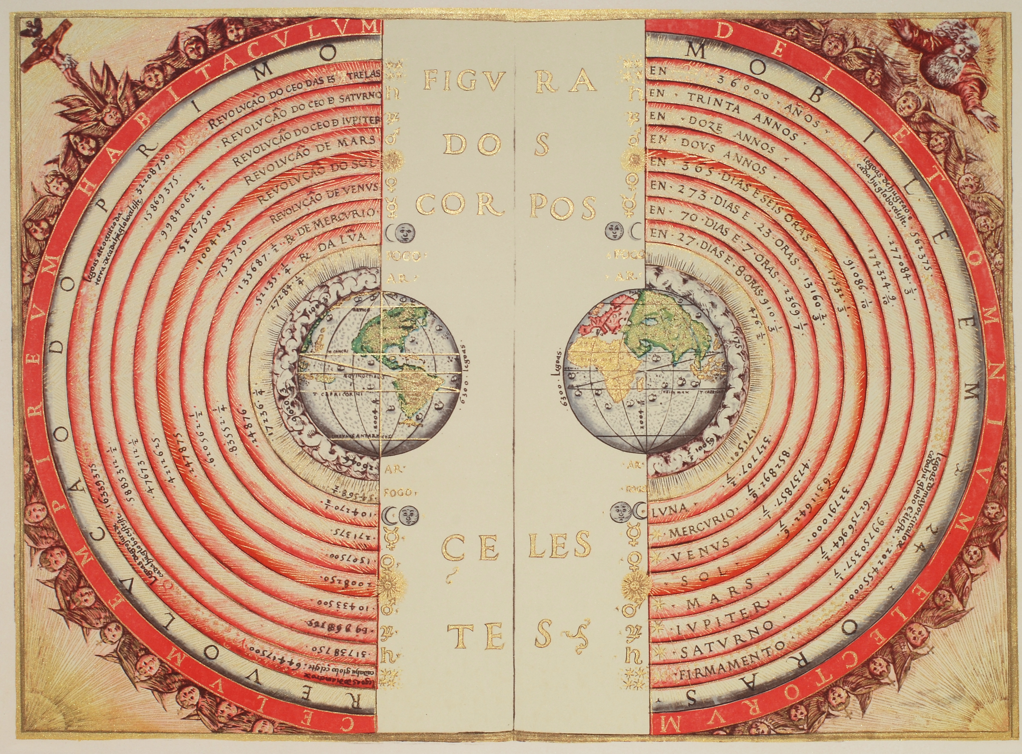
A Geocentric chart from 1568
صورة
الشرح: This map, created in 1568 by the Portuguese cartographer Bartolomeu Velho, depicts the worldview of the time, when many scholars believed in a geocentric model of the cosmos — the idea that Earth sits at the centre of the Universe with the Sun, Moon, the five planets known at the time, and stars moving around it. The design and layout of this map were influenced by astronomical understanding rooted in geocentric thinking.
The geocentric model was widely accepted for many centuries, especially in Europe, based on interpretations of celestial motions and philosophical traditions that placed Earth at the centre. It was only later, with observations by astronomers such as, Galileo Galilei, that this model was replaced by the heliocentric model, which places the Sun at the centre of the Solar System.
المصدر: Bartolomeu Velho
رابط المصدر
مصطلحات المعجم:
نموذج مركزية الأرض , النموذج العلمي
الترخيص: الملكية العامة الملكية العامة أيقونات
ملف
( صورة
12.99 MB)

Copernicus's heliocentric system
صورة
الشرح: Sketch of Copernicus's heliocentric model of the Solar System, from his book "De revolutionibus orbium coelestium" (On the revolution of the heavenly spheres) published in 1543. Shown are the Sun as well as the orbits of Mercury, Venus, the Earth (itself orbited by the Moon), Mars, Jupiter and Saturn. The outermost circle represents the sphere of the stars.
In this model, the Earth is not special – it is merely one planet, among several, orbiting the Sun. This was the first example for what is now known as the Copernican Principle: that our positions as observers in the universe is not special or privileged in any way. The shift from the geocentric to the heliocentric model of our universe is known as the Copernican revolution.
المصدر: Nicolaus Copernicus
رابط المصدر
مصطلحات المعجم:
ثورة كوبرنيكوس , نموذج مركزية الشمس , النموذج العلمي , مبدأ كوبرنيكوس
فئات:
النظام الشمسي
الترخيص: الملكية العامة الملكية العامة أيقونات
ملف
( صورة
702.64 kB)