Documents & Resources - Search Results
Search results
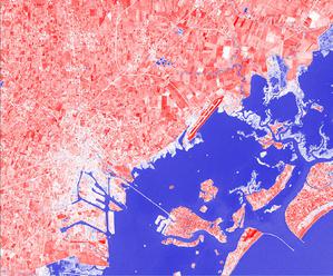
A View from Above astroEDU educational activity (links to astroEDU website) Description: How do satellites take images of the Earth surface and how do we analyse and use them?
Termos do Glossário:
Terra , Luz , Satélite artificial
Categories:
Planet Earth
, Telescopes, Instruments and Observatories
Tags:
Climate
, Copernicus
, Earth observation
, Landsat
, Maps
, Remote sensing
, Sentinel
, Vegetation
Age Ranges:
14-16
, 16-19
Education Level:
Middle School
, Secondary
Areas of Learning:
Structured-inquiry learning
Costs:
Low Cost
Duration:
1 hour 30 mins
Group Size:
Group
Skills:
Analysing and interpreting data
, Asking questions
, Communicating information
, Constructing explanations
, Developing and using models
, Engaging in argument from evidence
, Using mathematics and computational thinking
Authors: Markus Nielbock
License: Creative Commons Attribution 4.0 International (CC BY 4.0) Creative Commons Attribution 4.0 International (CC BY 4.0) icons