文档与资源 - 搜索结果
搜索结果
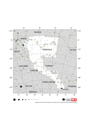
Eridanus Constellation Map
图像
图注: The constellation Eridanus with its bright stars and surrounding constellations. Eridanus is surrounded by (going clockwise from the top): Taurus, Cetus, Fornax, Phoenix, Tucana, Hydrus, Horologium, Caelum, Lepus and Orion.
Eridanus is a large constellation that spans a wide range in declination. A small portion of the constellation is in the northern hemisphere with the southern-most point lying at a declination of almost -60°. As it spans the celestial equator, parts of the constellation are visible to the whole Earth at some point in the year. The whole constellation can be observed from northern and southern equatorial regions, southern temperate regions and most of Antarctica. Eridanus is best viewed in the evening in the northern hemisphere winter and southern hemisphere summer.
The y-axis of this diagram is in degrees of declination with north as up and the x-axis is in hours of right ascension with east to the left. The sizes of the stars marked here relate to the star's apparent magnitude, a measure of its apparent brightness. The larger dots represent brighter stars. The Greek letters mark the brightest stars in the constellation. These are ranked by brightness with the brightest star being labeled alpha, the second brightest beta, etc., although this ordering is not always followed exactly. The dotted boundary lines mark the IAU's boundaries of the constellations and the solid green lines mark one of the common forms used to represent the figures of the constellations. Neither the constellation boundaries, nor the lines joining the stars appear on the sky.
来源: Adapted by the IAU Office of Astronomy for Education from the original by the IAU and Sky & Telescope
来源链接
词汇表:
视星等 , 天球坐标 , 星座 , 赤纬 , 赤经(RA) , 金牛座 , 猎户座
分类:
肉眼天文学
授权许可: 知识共享许可协议 署名 4.0 国际 (CC BY 4.0) 知识共享许可协议 署名 4.0 国际 (CC BY 4.0) 图标
文件
( 图像
148.42 kB)
PDF 文件
(PDF file
243.47 kB)
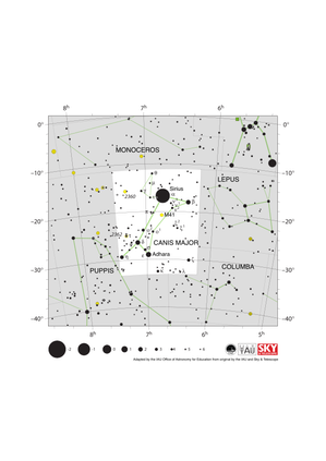
Canis Major Constellation Map
图像
图注: The constellation Canis Major along with its bright stars and its surrounding constellations. Canis Major is surrounded by (going clockwise from the top): Monoceros, Lepus, Columba and Puppis. The constellation is dominated by Sirius, the star which appears brightest in the night sky, which far outshines all of the other stars in the constellation.
Canis Major lies just south of the celestial equator and is visible from all of the southern hemisphere as well as equatorial and temperate regions of the northern hemisphere. Sirius is visible from all but the most arctic regions. Canis Major is most visible in the evenings in late winter in the northern hemisphere and late summer in the southern hemisphere.
The open star clusters M41, NGC 2360 and NGC 2362 lie in the constellation. These are marked with yellow circles.
The y-axis of this diagram is in degrees of declination with north as up and the x-axis is in hours of right ascension with east to the left. The sizes of the stars marked here relate to the star's apparent magnitude, a measure of its apparent brightness. The larger dots represent brighter stars. The Greek letters mark the brightest stars in the constellation. These are ranked by brightness with the brightest star being labeled alpha, the second brightest beta, etc., although this ordering is not always followed exactly. The dotted boundary lines mark the IAU's boundaries of the constellations and the solid green lines mark one of the common forms used to represent the figures of the constellations. Neither the constellation boundaries, nor the lines joining the stars appear on the sky.
来源: Adapted by the IAU Office of Astronomy for Education from the original by IAU/Sky & Telescope
来源链接
词汇表:
视星等 , 天球坐标 , 天赤道 , 星座 , 赤纬 , 赤经(RA) , 天狼星 , 疏散星团
分类:
肉眼天文学
授权许可: 知识共享许可协议 署名 4.0 国际 (CC BY 4.0) 知识共享许可协议 署名 4.0 国际 (CC BY 4.0) 图标
文件
( 图像
116.56 kB)
PDF 文件
(PDF file
200.43 kB)

Serpens Caput Constellation Map
图像
图注: A map of part of the constellation Serpens. Serpens is unique amongst IAU constellations in that it is divided into two non-contiguous parts. The part of Serpens shown here is known as Serpens Caput, representing the head of the serpent. This part of Serpens is surrounded by (going clockwise from the top): Corona Borealis, Boötes, Virgo, Libra, Ophiuchus and Hercules.
Serpens Caput spans the celestial equator thus parts of the constellation are visible at some point in the year across the Earth. The whole constellation is visible to temperate and equatorial regions of the southern hemisphere and all of the northern hemisphere except a small region around the north pole. Serpens Caput is best viewed in the evening in the northern hemisphere summer and southern hemisphere winter.
The globular cluster M5 lies in Serpens Caput. It is marked here with a yellow circle with a plus sign superimposed on it.
The y-axis of this diagram is in degrees of declination with north as up and the x-axis is in hours of right ascension with east to the left. The sizes of the stars marked here relate to the star's apparent magnitude, a measure of its apparent brightness. The larger dots represent brighter stars. The Greek letters mark the brightest stars in the constellation. These are ranked by brightness with the brightest star being labeled alpha, the second brightest beta, etc., although this ordering is not always followed exactly. The dotted boundary lines mark the IAU's boundaries of the constellations and the solid green lines mark one of the common forms used to represent the figures of the constellations. Neither the constellation boundaries, nor the lines joining the stars appear on the sky.
来源: Adapted by the IAU Office of Astronomy for Education from the original by the IAU and Sky & Telescope
来源链接
词汇表:
视星等 , 天球坐标 , 天赤道 , 星座 , 赤纬 , 球状星团 , 天秤座 , 赤经(RA) , 室女座
分类:
肉眼天文学
授权许可: 知识共享许可协议 署名 4.0 国际 (CC BY 4.0) 知识共享许可协议 署名 4.0 国际 (CC BY 4.0) 图标
文件
( 图像
97.60 kB)
PDF 文件
(PDF file
161.10 kB)

Equuleus Constellation Map
图像
图注: The constellation Equuleus with its brighter stars and surrounding constellations. Equuleus is surrounded by (going clockwise from the top): Delphinus, Aquarius and Pegasus. It is a relatively small constellation with few bright stars.
Equuleus lies just north of the celestial equator and thus the whole constellation is visible at some point in the year to all but the most antarctic regions. Equuleus is best viewed in the evening in the early northern hemisphere autumn and early southern hemisphere spring.
The y-axis of this diagram is in degrees of declination with north as up and the x-axis is in hours of right ascension with east to the left. The sizes of the stars marked here relate to the star's apparent magnitude, a measure of its apparent brightness. The larger dots represent brighter stars. The Greek letters mark the brightest stars in the constellation. These are ranked by brightness with the brightest star being labeled alpha, the second brightest beta, etc., although this ordering is not always followed exactly. The dotted boundary lines mark the IAU's boundaries of the constellations and the solid green lines mark one of the common forms used to represent the figures of the constellations. Neither the constellation boundaries, nor the lines joining the stars appear on the sky.
来源: Adapted by the IAU Office of Astronomy for Education from the original by the IAU and Sky & Telescope
来源链接
词汇表:
视星等 , 天球坐标 , 星座 , 赤纬 , 赤经(RA) , 宝瓶座
分类:
肉眼天文学
授权许可: 知识共享许可协议 署名 4.0 国际 (CC BY 4.0) 知识共享许可协议 署名 4.0 国际 (CC BY 4.0) 图标
文件
( 图像
61.60 kB)
PDF 文件
(PDF file
143.63 kB)

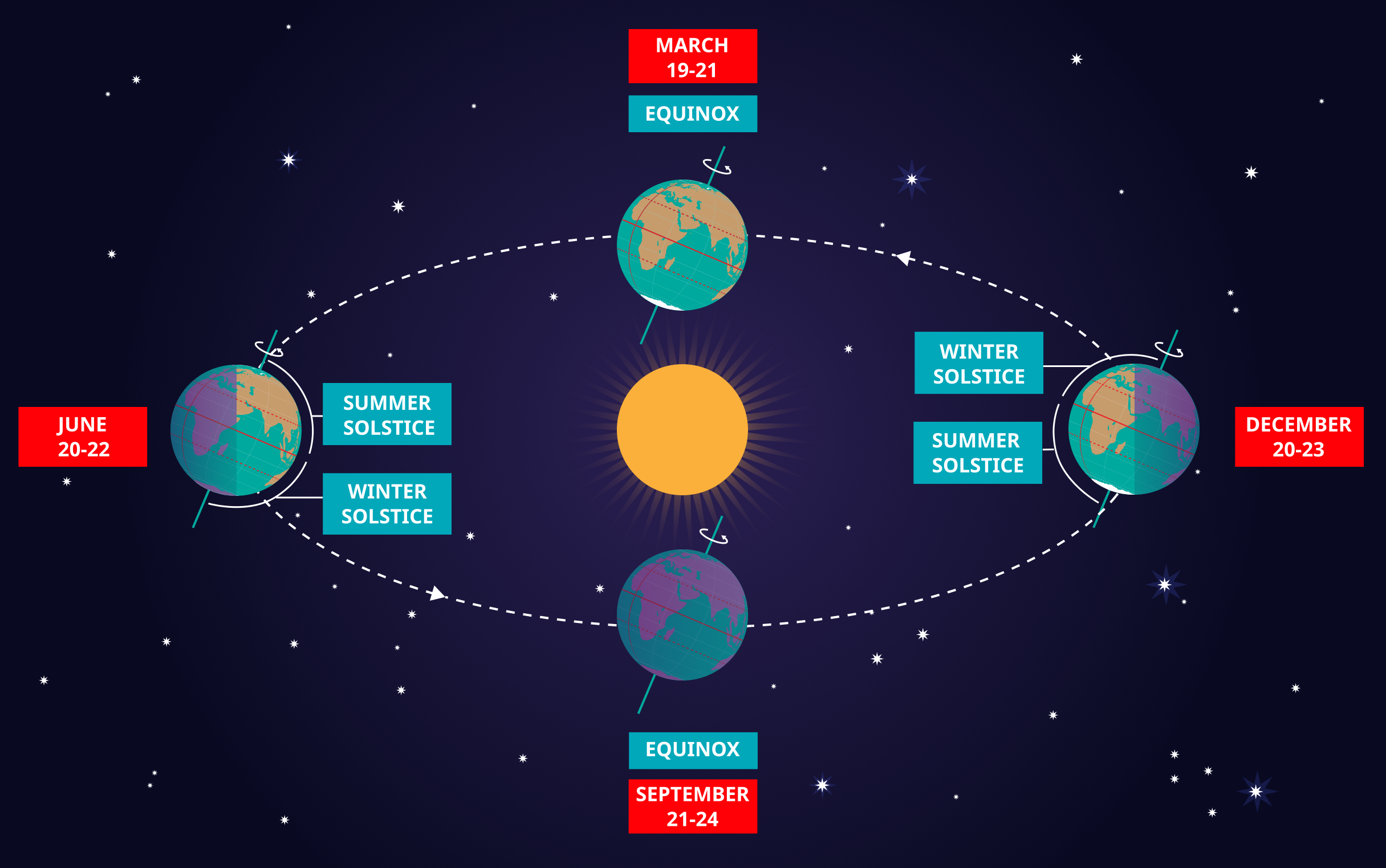
Solstices and Equinoxes
图像
为 OAE 制作
图注: This diagram demonstrates the relative positions of the Earth and Sun at the two solstices and two equinoxes. The Earth’s rotation axis is tilted by 23.4° from the axis of its orbit. This means that for half the Earth’s annual orbit around the Sun, the Southern Hemisphere is tilted towards the Sun and the Northern Hemisphere is tilted away from the Sun. During this time the Sun appears to lie below the celestial equator. Due to this at any particular point in the Southern Hemisphere the Sun will appear to be higher above the horizon at a particular time of day and the days will be longer. Conversely during this time, the Sun appears lower in the sky at any particular point in the day in the Northern Hemisphere and the days are shorter.
This effect is most pronounced in late December when the Sun appears at its most southerly point in the sky, corresponding to the longest day of the year in the Southern Hemisphere. This normally occurs on the 21st or 22nd of December (UTC), depending on when the most recent leap year was, but can very occasionally occur on the 20th or 23rd of December. This event is known as the December solstice. As the Sun’s rays hit the Southern Hemisphere at a more perpendicular angle during this time, the Southern Hemisphere is typically warmer in this time of year than at other times of year. This is often referred to as summer in temperate and antarctic regions of the Southern Hemisphere and thus the December solstice is known as the summer solstice. South of the Antarctic Circle at this time the Sun never sets and a Polar Day can last several months. Conversely in the Northern Hemisphere, the Sun’s rays hit the Earth at a more grazing angle than at other times of year so it is colder and this solstice is known as the winter solstice. North of the Arctic Circle the Sun never rises during this time and the Polar Night can last several months.
As the year progresses the Earth moves in its orbit and the tilt of the Earth’s axis moves so it appears more side-on to the Sun. From the perspective of an observer on Earth this means that the Sun moves north in the sky, eventually reaching the celestial equator in late March, This usually occurs on the 20th of March (UTC) but can sometimes occur on the 19th or 21st of March. During this time all places on Earth will experience night and day that is approximately 12 hours long. The Sun’s rays now hit the Southern hemisphere at a more shallow angle than they did in December and hit the Northern Hemisphere at a more perpendicular angle. This means that the Northen Hemisphere will have warmed since December and the Southern Hemisphere cooled. This leads to the March equinox being referred to as the autumn equinox in the Southern Hemisphere and the spring or vernal equinox in the Northern Hemisphere.
As the year progresses further the Sun moves further north on the sky, the Northern Hemisphere days lengthen and the Southern Hemisphere days shorten. By June the Earth’s orbit has progressed to the point where the Northern Hemisphere points towards the Sun and the Southern Hemisphere away from the Sun. At one point between the 20th and 22nd of June (UTC) the Sun reaches its most northerly point in the sky, this is known as June solstice. It is now summer in northern temperate and artic regions so this is known as the summer solstice in the Northern Hemisphere and the winter solstice in the Southern Hemisphere. This is the longest day of the year in the Northern Hemisphere and the shortest day of the year in the Southern Hemisphere. During this time regions north of the Arctic Circle experience a long Polar Day and regions south of the Antarctic Circle experience polar night.
The year progresses further and the Earth moves in its orbit so that the tilt of the Earth’s axis again appears side-on for the Sun. The Sun moves south in the sky and again crosses the celestial equator between the 21st and 24th of September (UTC). At this time all places on the Earth experience equal lengths of day and night. This is known as the September equinox, also called the spring or vernal equinox in the Southern Hemisphere and the autumn equinox in the Northern Hemisphere.
Note the sizes of the Earth, Sun and the Earth’s orbit around the Sun are not to scale in this diagram.
来源: Maria Cristina Fortuna/IAU OAE
词汇表:
昼夜平分点 , 天赤道 , 季节 , 二至点 , 夏至 , 冬至 , 春分 , 秋分 , 地轴 , 北极圈 , 南极圈 , 极昼 , 极夜
分类:
肉眼天文学
授权许可: 知识共享许可协议 署名 4.0 国际 (CC BY 4.0) 知识共享许可协议 署名 4.0 国际 (CC BY 4.0) 图标
文件
( 图像
2.02 MB)
PDF 文件
(PDF file
335.83 kB)
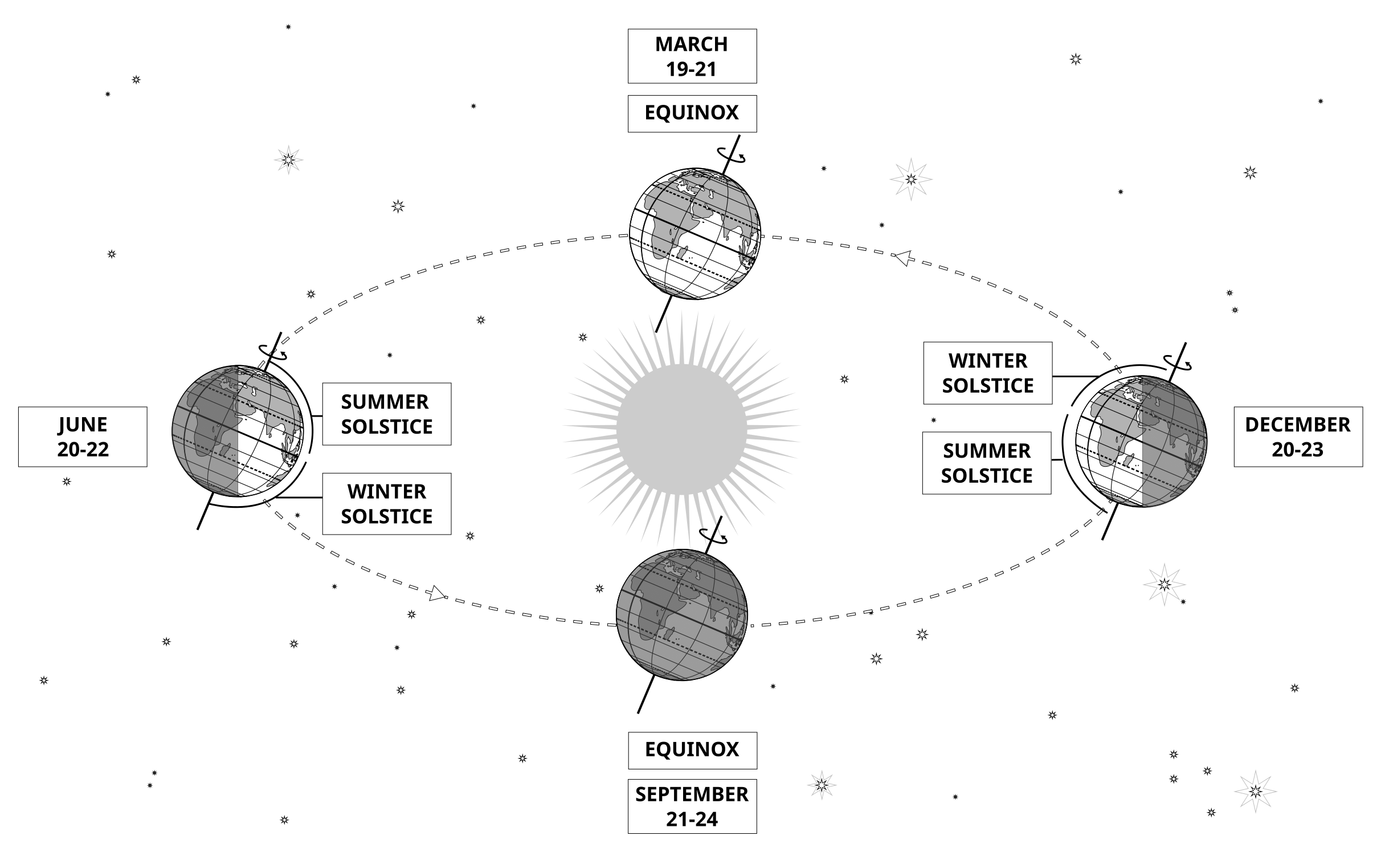
Also available in black and white
文件
( 图像
485.38 kB)
PDF 文件
(
388.16 kB)