Glossarbegriffe: Io
Description: Io ist ein Mond oder Satellit, der den Planeten Jupiter umkreist und 1610 von Galileo Galilei entdeckt wurde. Er ist der innerste der vier größten Jupitersatelliten. Io umkreist den Jupiter alle 42,5 Stunden in einem Abstand von 422 000 Kilometern zum Planeten. Io hat viele aktive Vulkane auf seiner Oberfläche. Das ist auf die starken Gezeitenkräfte zurückzuführen, denen der Satellit während seines Umlaufs um Jupiter ausgesetzt ist.
Zugehörige Glossarbegriffe:
See this term in other languages
Term and definition status: The original definition of this term in English have been approved by a research astronomer and a teacher The translation of this term and its definition is still awaiting approval
The OAE Multilingual Glossary is a project of the IAU Office of Astronomy for Education (OAE) in collaboration with the IAU Office of Astronomy Outreach (OAO). The terms and definitions were chosen, written and reviewed by a collective effort from the OAE, the OAE Centers and Nodes, the OAE National Astronomy Education Coordinators (NAECs) and other volunteers. You can find a full list of credits here. All glossary terms and their definitions are released under a Creative Commons CC BY-4.0 license and should be credited to "IAU OAE".
If you notice a factual or translation error in this glossary term or definition then please get in touch.
Zugehörige Medien
Jupiter Moons Movie2, by Nicolas Hurez, Paul-Antoine Matrangolo, and Carl Pennypacker, United States of America
Bildnachweis: Nicolas Hurez, Paul-Antoine Matrangolo and Carl Pennypacker/IAU OAE
License: CC-BY-4.0 Creative Commons Namensnennung 4.0 International (CC BY 4.0) icons
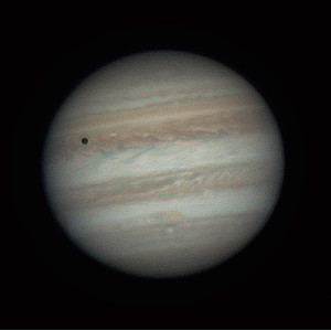
Jupiter, Io and its shadow, by Ralf Burkart, Germany
Bildnachweis: Ralf Burkart/IAU OAE
License: CC-BY-4.0 Creative Commons Namensnennung 4.0 International (CC BY 4.0) icons
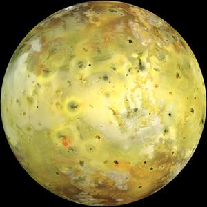
Io
Bildnachweis: NASA/JPL/University of Arizona credit link
License: PD Public Domain icons
Related Activities
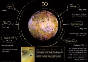
Children's Planetary Maps: Io
astroEDU educational activity (links to astroEDU website) Description: Learn about the most geologically active world in our Solar System
License: CC-BY-4.0 Creative Commons Namensnennung 4.0 International (CC BY 4.0) icons
Tags:
Maps
, Planetary cartography
, Spatial thinking
Age Ranges:
6-8
, 8-10
, 10-12
, 12-14
Education Level:
Middle School
, Primary
, Secondary
Areas of Learning:
Social Research
Costs:
Low Cost
Duration:
2 hours
Group Size:
Group
Skills:
Analysing and interpreting data
, Asking questions
, Communicating information
, Constructing explanations
, Developing and using models
, Engaging in argument from evidence
, Planning and carrying out investigations

