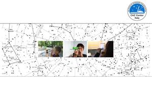
Glossarbegriffe: Himmelskarte
Description: Eine Himmelskarte gibt die Position von astronomischen Objekten (Sterne, Planeten, Sonne, Mond usw.) am Himmel zu einem bestimmten Zeitpunkt an.
Mit Himmelskarten können Astronomen herausfinden, wo sich ein Objekt am Nachthimmel befindet. Sie können auch zur Navigation benutzt werden.
In der modernen astronomischen Forschung werden Himmelskarten als Teil von Durchmusterungen erstellt, die eine Vielzahl von Informationen über die von ihnen untersuchten Objekte aufzeichnen.
Interaktive Himmelskarten für die breite Öffentlichkeit sind als Computerprogramme oder mobile Anwendungen erhältlich.
Zugehörige Glossarbegriffe:
See this term in other languages
Term and definition status: The original definition of this term in English have been approved by a research astronomer and a teacher The translation of this term and its definition is still awaiting approval
The OAE Multilingual Glossary is a project of the IAU Office of Astronomy for Education (OAE) in collaboration with the IAU Office of Astronomy Outreach (OAO). The terms and definitions were chosen, written and reviewed by a collective effort from the OAE, the OAE Centers and Nodes, the OAE National Astronomy Education Coordinators (NAECs) and other volunteers. You can find a full list of credits here. All glossary terms and their definitions are released under a Creative Commons CC BY-4.0 license and should be credited to "IAU OAE".
If you notice a factual or translation error in this glossary term or definition then please get in touch.
Related Activities
The sky at your fingertips
astroEDU educational activity (links to astroEDU website) Description: Build a simple cross-staff and measure the stars!
License: CC-BY-4.0 Creative Commons Namensnennung 4.0 International (CC BY 4.0) icons
Age Ranges:
10-12
, 12-14
Education Level:
Middle School
, Primary
Areas of Learning:
Informal/Field Trip Related
, Observation based
, Project-based learning
Costs:
Low Cost
Duration:
2 hours
Skills:
Analysing and interpreting data
, Developing and using models


