Glossary term: रेखांश
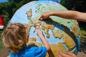
Description: दुनिया गोल है। पृथ्वी पर स्थानों को परिभाषित करने के लिए गोले की सतह पर काल्पनिक रेखाओं के दो सेट खींचे जाते हैं। देशांतर रेखाएँ बड़े वृत्त हैं जो पृथ्वी के चारों ओर घूमते हैं और उत्तरी और दक्षिणी ध्रुवों से होकर गुजरते हैं। जबकि भूमध्य रेखा 0 अक्षांश के लिए एक प्राकृतिक संदर्भ बिंदु प्रदान करती थी, वैसे 0 रेखांश की रेखा कसी जगह पर स्वीकार करनी पडी। 0 रेखांश की मान्यता प्राप्त रेखा लंदन, यूके में ग्रीनविच से होकर गुजरती है और इसे प्राइम मेरिडियन या ग्रीनविच मेरिडियन के रूप में भी जाना जाता है। एंटीमेरिडियन दुनिया भर में 180 डिग्री है और अंतर्राष्ट्रीय तिथि रेखा का आधार है। पृथ्वी के चारों ओर की कुल दूरी 360 डिग्री है। भूमध्य रेखा के समानांतर पृथ्वी के चारों ओर छोटे-छोटे वृत्तों में भी रेखाएँ हैं। ये अक्षांश रेखाएं हैं.
Related Terms:
See this term in other languages
Term and definition status: The original definition of this term in English have been approved by a research astronomer and a teacher The translation of this term and its definition is still awaiting approval
The OAE Multilingual Glossary is a project of the IAU Office of Astronomy for Education (OAE) in collaboration with the IAU Office of Astronomy Outreach (OAO). The terms and definitions were chosen, written and reviewed by a collective effort from the OAE, the OAE Centers and Nodes, the OAE National Astronomy Education Coordinators (NAECs) and other volunteers. You can find a full list of credits here. All glossary terms and their definitions are released under a Creative Commons CC BY-4.0 license and should be credited to "IAU OAE".
If you notice a factual or translation error in this glossary term or definition then please get in touch.
Related Activities
Let's Map the Earth
astroEDU educational activity (links to astroEDU website) Description: Discover how to read and draw maps by observing.
License: CC-BY-4.0 Creative Commons Attribution 4.0 International (CC BY 4.0) icons
Tags:
Hands-on
, Scales
, Geography
, Maps
, GPS
, Coordinates
Age Ranges:
8-10
, 10-12
Education Level:
Primary
Areas of Learning:
Modelling
, Social Research
Costs:
Low Cost
Duration:
1 hour
Group Size:
Group
Skills:
Analysing and interpreting data
How To Travel on Earth Without Getting Lost
astroEDU educational activity (links to astroEDU website) Description: Use a globe to describe your position on Earth.
License: CC-BY-4.0 Creative Commons Attribution 4.0 International (CC BY 4.0) icons
Tags:
Geography
, Maps
, GPS
, Celestial navigation
Age Ranges:
8-10
, 10-12
, 12-14
Education Level:
Middle School
, Primary
Areas of Learning:
Social Research
Costs:
Low Cost
Duration:
1 hour
Group Size:
Group
Skills:
Analysing and interpreting data
, Developing and using models
, Using mathematics and computational thinking


