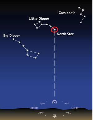
Glossar-Begriff: Längengrad
Beschreibung: Die Erde ist eine Kugel. Um Positionen auf der Erde zu definieren, werden zwei Gruppen von gedachten Linien auf die Oberfläche der Kugel gezeichnet. Die Längengradlinien sind Großkreise, die um die Erde und durch den Nord- und den Südpol verlaufen. Während der Äquator einen natürlichen Bezugspunkt für den 0. Breitengrad darstellt, musste man die Linie des 0. Längengrads festlegen. Diese Linie (Halbkreis) des 0. Längengrades verläuft durch Greenwich in London, Großbritannien, und wird auch als Nullmeridian oder Greenwich-Meridian bezeichnet. Der Antemeridian liegt auf der entgegengesetzten Seite der Erde bei 180 Grad. Er ist die Grundlage für die internationale Datumsgrenze. Die volle Entfernung einmal um die Erde beträgt 360 Grad. Es gibt auch Linien, die parallel zum Äquator in Kreisen um die Erde verlaufen. Dies sind die Breitengradlinien.
Ähnliche Begriffe:
Dieser Begriff in anderen Sprachen
Begriffs- und Definitionsstatus Die Originaldefinition dieses Begriffes auf Englisch wurden von einem forschenden Astronom und einer Lehrkraft bestätigt Die Übersetzung dieses Begriffs und seiner Definition warten auf Prüfung und Bestätigung
The OAE Multilingual Glossary is a project of the IAU Office of Astronomy for Education (OAE) in collaboration with the IAU Office of Astronomy Outreach (OAO). The terms and definitions were chosen, written and reviewed by a collective effort from the OAE, the OAE Centers and Nodes, the OAE National Astronomy Education Coordinators (NAECs) and other volunteers. You can find a full list of credits here. All glossary terms and their definitions are released under a Creative Commons CC BY-4.0 license and should be credited to "IAU OAE".
Wenn dir ein inhaltlicher oder Übersetzungsfehler in diesem Glossarbegriff oder dieser Definition auffallen, bitte kontaktiere uns.
Ähnliche Medien

Karte der De-facto-Zeitzonen auf der Erde
Unterschrift: Aufgrund der Kugelform der Erde und ihrer Drehung um die eigene Achse variiert der lokale Mittag - der Zeitpunkt, zu dem die Sonne für einen Beobachter an einem bestimmten geografischen Ort ihren höchsten Stand am Himmel erreicht - mit der geografischen Länge. Aus diesem Grund könnte eine Zeitkoordinate wie die Weltzeit (UT oder UTC) von Vorteil sein, um Zeitpunkte auf einheitliche Weise festzulegen. Aber eine globale Zeitkoordinate wird an den meisten Orten der Erde nicht mit dem lokalen Tag-Nacht-Rhythmus übereinstimmen. Ein Kompromiss besteht darin, die Erde in Zonen zu unterteilen, die jeweils 15 Längengrade umfassen, und in jeder Zone die Zeit als UTC plus oder minus einer ganzzahligen Anzahl von Stunden zu definieren, wobei der Versatz so gewählt wird, dass die Zeit möglichst genau mit der Ortszeit auf dem mittleren Längengrad der Zeitzone übereinstimmt. In der Praxis haben politische Erwägungen die Grenzen der Zeitzonen etwas verändert. Wenn sich ein Land über mehrere Zeitzonen erstreckt, ist es nicht ungewöhnlich, dass die Regierung des Landes eine dieser Zeitzonen für die Festlegung der offiziellen Zeit des Landes wählt.
Diese Karte, die ursprünglich von der CIA erstellt und von mehreren Wikimedia Commons-Benutzern aktualisiert wurde, zeigt die aktuellen Definitionen der Zeitzonen der Welt. Das IAU OAE ist nicht der ursprüngliche Autor dieser Karte. Die verwendeten Bezeichnungen und die Darstellung des Materials auf dieser Karte bedeuten nicht, dass die IAU oder das IAU OAE eine wie auch immer geartete Meinung über den rechtlichen Status eines Landes, eines Gebiets, einer Stadt oder seiner Behörden oder über den Verlauf seiner Grenzen zum Ausdruck bringt.
Bild: Wikimedia-Benutzer UnaitxuGV, Heitordp und andere auf der Grundlage einer von der U.S. Central Intelligence Agency (CIA) erstellten Karte
Quellenlink
License: PD Gemeinfrei Symbole
Ähnliche Diagramme

Latitude and Longitude
Unterschrift: Two views of the Earth, one viewing the Northern Hemisphere, one viewing the Southern Hemisphere. The Earth rotates around its axis, an imaginary line that runs through the Earth from the North Pole to the South Pole. The Equator is an imaginary line that is the same distant from both the North Pole and the South Pole.
The positions of two cities, Rome in the Northern Hemisphere and Sydney in the Southern Hemisphere are marked here with red dots. Arrows indicate the two spherical coordinates latitude and longitude.
Latitude marks the position north or south of the equator. Here we can see Rome has the letter N in its latitude as it is in the Northern Hemisphere and Sydney has the letter S in its latitude as it is in the Southern Hemisphere. Latitude can vary from 90° N at the North Pole to 0° at the Equator to 90° S at the South Pole.
Longitude measures the position around the equator. While the choice of the zero point for latitude as the equator seems obvious, the choice of the zero point for longitude is more subjective. By convention the zero point in longitude is the prime meridian which passes through the Royal Greenwich Observatory in the UK. This is marked here as a solid line originating at the North Pole. Longitude is measured in degrees east or west of the prime meridian. As both Rome and Sydney lie to the east of Greenwich, they have the letter E as part of their longitude. Moving west to east, longitude varies from 180° W on the other side of the world from the prime meridian to 0° on the prime meridian before reaching 180° E again on the other side of world from the prime meridian.
This diagram shows the Earth at the December solstice. Two views are presented, one viewing the Northern Hemisphere and one viewing the Southern Hemisphere about nine hours later. The shaded region shows the night side of the Earth, with the day side being lighter. As it is the December solstice, the Sun appears overhead at the Tropic of Capricorn. This is a line of constant latitude at 23°26′09.3″ S. Six months later, at the June solstice, the Sun will appear to be overhead at the Tropic of Cancer at 23°26′09.3″ N. As the Sun appears over the Tropic of Capricorn more of the Southern Hemisphere is illuminated than the Northern Hemisphere. Indeed below the Antarctic Circle (the Polar Circle around the South Pole) the Sun does not set at this time of year leading to a Polar Day. Conversely, north of the Arctic Circle (the Polar Circle around the North Pole) the Sun does not rise at this time of year, leading to a Polar Night.
Bild: Maria Cristina Fortuna/IAU OAE
License: CC-BY-4.0 Creative Commons Namensnennung 4.0 International (CC BY 4.0) Symbole
Ähnliche Aktivitäten

Let's Map the Earth
astroEDU educational activity (links to astroEDU website) Description: Discover how to read and draw maps by observing.
License: CC-BY-4.0 Creative Commons Namensnennung 4.0 International (CC BY 4.0) Symbole
Schlagworte
Hands-on
, Scales
, Geography
, Maps
, GPS
, Coordinates
Altersgruppen:
8-10
, 10-12
Bildungsniveau:
Primary
Lernbereiche:
Modelling
, Social Research
Kosten:
Low Cost
Dauer:
1 hour
Gruppengröße:
Group
Fähigkeiten:
Analysing and interpreting data
How To Travel on Earth Without Getting Lost
astroEDU educational activity (links to astroEDU website) Description: Use a globe to describe your position on Earth.
License: CC-BY-4.0 Creative Commons Namensnennung 4.0 International (CC BY 4.0) Symbole
Schlagworte
Geography
, Maps
, GPS
, Celestial navigation
Altersgruppen:
8-10
, 10-12
, 12-14
Bildungsniveau:
Middle School
, Primary
Lernbereiche:
Social Research
Kosten:
Low Cost
Dauer:
1 hour
Gruppengröße:
Group
Fähigkeiten:
Analysing and interpreting data
, Developing and using models
, Using mathematics and computational thinking
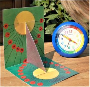
Mit der Sonne die Zeit messen
astroEDU educational activity (links to astroEDU website) Description: Wer kennt das nicht: vor dem Schwimmen wurde das Badehandtuch in den Schatten unter den Sonnenschirm gelegt, und jetzt liegt das Tuch in der prallen Sonne und muss verschoben werden – und zwar nicht nur einmal, sondern immer wieder. Als könne man die Uhr danach stellen. Und tatsächlich kann man das! Der beständige Lauf der Sonne über den Taghimmel ist die Grundlage für die Konstruktion besonderer Uhren, der Sonnenuhren. Wie eine Sonnenuhr funktioniert und warum einfache Sonnenuhren nicht jeden Tag die genaue Uhrzeit anzeigen werden, ist der Inhalt dieses WIS-Beitrags. Mit Hilfe einer selbst hergestellten Sonnenuhr aus Papier und einer App zur Visualierung einer Sonnenuhr können die Schülerinnen und Schüler ein Großteil der Messungen eigenständig durchführen.
Altersgruppen: 14-16 , 16-19 Bildungsniveau: Secondary
Wo der Mond auf dem Kopf steht und die Sonne verkehrt herum läuft – ein hybrides Lernangebot
astroEDU educational activity (links to astroEDU website) Description: Da staunt die Urlauberfamilie aus Deutschland nicht schlecht: obwohl wir alle auf demselben Planeten Erde wohnen und wir alle in denselben Himmel blicken, scheinen der Mond und auch die Sternbilder bei der Safari in Südafrika betrachtet auf dem Kopf zu stehen! Auch die Sonne benimmt sich merkwürdig: sie geht zwar wie gewohnt in östlicher Richtung auf und in westlicher Richtung unter, aber ihre Bahn verläuft anders als bei uns in Europa über die Nordrichtung – also falsch herum. Mit Hilfe des kostenlosen und quelloffenen Astronomieprogramms Stellarium sollen die Schüler*innen der Ursache dafür im Rahmen eines hybriden Lernarrangements auf den Grund gehen. Die Unterrichtseinheit ist ausgelegt für drei Video-Unterrichtseinheiten im Klassenverband und zwei Hausaufgaben-phasen, in denen die Schüle*rinnen mit Stellarium zuhause arbeiten. Das Angebot kann natürlich auch während eines regulären Präsensunterrichts durchgeführt werden. Wichtig ist im Zusammenhang mit einem Hybridunterricht (Kombination aus Online- und Präsenzangeboten), dass sich die Schüler*innen mit in den Unterricht einbringen, ihre Bildschirme mit der Klassengemeinschaft teilen können und es so zu einer aktiven Teilnahme und nicht bloß zu einem Besuch des Unterrichts kommt.
Altersgruppen: 10-12 , 12-14 , 14-16 Bildungsniveau: Middle School , Secondary
Der Pendelquadrant Wegweiser der Nautik
astroEDU educational activity (links to astroEDU website) Description: Im WiS!-Beitrag wird die unterliegende Theorie des Pendelquadranten mit einem Exkurs über Breiten- und Längengrade dargestellt, sowie eine Bastel- und Bedienungsanleitung mit dazugehörigen Messaufgaben angeboten.
Altersgruppen: 14-16 , 16-19 Bildungsniveau: Secondary
