Loading...

Glossary term: Ascension droite (AD)

Description: L'ascension droite est l'une des deux coordonnées du système de coordonnées équatoriales (l'autre étant la déclinaison), que les astronomes utilisent pour définir les positions des objets célestes dans le ciel. Vues de la Terre, les différentes positions dans le ciel forment ensemble ce qui semble être une sphère lointaine avec la Terre en son centre. Les points du ciel situés directement au-dessus de l'équateur terrestre forment l'équateur céleste sur cette sphère. Le point situé directement au-dessus du pôle Nord géographique de la Terre est le pôle Nord céleste, et celui situé au-dessus du pôle Sud de la Terre est le pôle Sud céleste. Tout comme les géographes définissent la longitude et la latitude géographiques à la surface de la Terre, on peut définir la longitude et la latitude sur la sphère céleste. Si l'on choisissait la coordonnée de longitude d'un objet céleste comme étant celle de l'endroit de la Terre situé juste en dessous, la valeur de la coordonnée d'une étoile changerait au fil du temps, au fur et à mesure que la Terre tournerait. Au lieu de cela, les coordonnées équatoriales mesurent l'ascension droite comme une forme de longitude céleste par rapport à un "méridien" dans le ciel qui ne tourne pas avec la Terre, mais qui est fixe par rapport aux étoiles. Ce méridien, analogue au méridien de Greenwich sur Terre, est défini par son intersection avec l'équateur céleste : Au point exact où la trajectoire apparente du Soleil traverse l'équateur céleste de l'hémisphère céleste sud à l'hémisphère céleste nord. Cette longitude est appelée ascension droite. Sa valeur augmente vers l'est. Si vous regardez vers l'équateur céleste, les valeurs de longitude passeront devant vous en 24 heures (environ). C'est pourquoi l'ascension droite est généralement indiquée comme une valeur temporelle, 24 heures correspondant aux 360 degrés. La déclinaison, deuxième coordonnée équatoriale, correspond à la latitude géographique. Une légère oscillation de l'axe de rotation de la Terre, connue sous le nom de précession, fait que le système de coordonnées équatoriales, et donc l'ascension droite et la déclinaison des étoiles et autres objets célestes, changent au fil du temps, mais seulement très légèrement et très lentement.

Related Terms:


See this term in other languages

Term and definition status: The original definition of this term in English have been approved by a research astronomer and a teacher
The translation of this term and its definition have been approved by a research astronomer and a teacher

The OAE Multilingual Glossary is a project of the IAU Office of Astronomy for Education (OAE) in collaboration with the IAU Office of Astronomy Outreach (OAO). The terms and definitions were chosen, written and reviewed by a collective effort from the OAE, the OAE Centers and Nodes, the OAE National Astronomy Education Coordinators (NAECs) and other volunteers. You can find a full list of credits here. All glossary terms and their definitions are released under a Creative Commons CC BY-4.0 license and should be credited to "IAU OAE".

If you notice a factual or translation error in this glossary term or definition then please get in touch.

Related Diagrams


Les étoiles brillantes d'Andromède forment un Y. Pégase en bas à droite. Au centre se trouve M31, marquée d'une ellipse rouge.

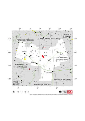
Carte de la constellation d'Andromède

Caption: La constellation d'Andromède montrant ses étoiles brillantes et les constellations environnantes. Andromède est entourée (dans le sens des aiguilles d'une montre à partir du haut) de Cassiopée, du Lézard, de Pégase, des Poissons, du Bélier, du Triangle et de Persée. L'étoile la plus brillante d'Andromède (Alpheratz) se trouve dans la partie inférieure de la constellation. Avec trois étoiles de Pégase, elle forme l'astérisme connu sous le nom de "Grand carré de Pégase". Les deux autres étoiles brillantes de la constellation (Mirach et Almach) forment une ligne qui s'étend au nord-est d'Alpheratz. Andromède est une constellation septentrionale et est surtout visible le soir, à l'automne dans l'hémisphère nord. Elle est visible depuis tout l'hémisphère nord et la plupart des régions tempérées de l'hémisphère sud, mais n'est pas visible depuis les régions antarctiques et subantarctiques. L'objet le plus célèbre d'Andromède, la galaxie d'Andromède, est marqué ici d'une ellipse rouge et de son numéro de catalogue Messier M31. Le cercle jaune à gauche indique la position de l'amas ouvert NGC 752 et le cercle vert à droite indique NGC 7662 (la nébuleuse de la boule de neige bleue), une nébuleuse planétaire. L'axe des y de ce diagramme est en degrés de déclinaison avec le nord en haut et l'axe des x est en heures d'ascension droite avec l'est à gauche. La taille des étoiles marquées ici correspond à la magnitude apparente de l'étoile, une mesure de sa luminosité apparente. Les points les plus gros représentent les étoiles les plus brillantes. Les lettres grecques indiquent les étoiles les plus brillantes de la constellation. Elles sont classées par ordre de luminosité, l'étoile la plus brillante étant étiquetée alpha, la deuxième plus brillante bêta, etc., bien que cet ordre ne soit pas toujours respecté à la lettre. Les lignes pointillées marquent les délimitations des constellations selon l'UAI et les lignes vertes pleines marquent l'une des formes couramment utilisées pour représenter les figures des constellations. Ni les limites des constellations, ni les lignes reliant les étoiles n'apparaissent sur le ciel.
Credit: Adapté par le Bureau de l'astronomie pour l'éducation de l'AIU à partir de l'original de l'AIU/Sky & Telescope

License: CC-BY-4.0 Creative Commons Attribution 4.0 International (CC BY 4.0) icons


The four bright stars of Crux form a kite shape with the long axis pointing vertically

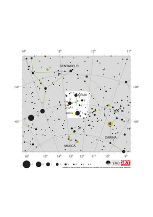
Crux Constellation Map

Caption: The constellation Crux (commonly known as the Southern Cross or Crux Australis) showing its bright stars and surrounding constellations. The Southern Cross is surrounding by (going clockwise from the top) Centaurus, Carina and Musca. The brightest star is alpha Crucis which appears at the bottom of the constellation's famous kite shape. The Southern Cross is visible from southern and equatorial regions of the world. In more southerly parts of the world it is circumpolar so is always above the horizon. In other parts of the southern hemisphere and in equatorial regions it is most visible in the evenings in the southern hemisphere autumn. The yellow circles show the locations of two open clusters, NGC 4755 (known as the Jewel Box) and NGC 4609. The line joining gamma and alpha Crucis (the third and first brightest stars in the Southern Cross) points in the approximate direction of the South Celestial Pole. This has led to the Southern Cross playing an important role in celestial navigation, allowing navigators from different astronomical traditions to find their bearings. The y-axis of this diagram is in degrees of declination with north as up and the x-axis is in hours of right ascension with east to the left. The sizes of the stars marked here relate to the star's apparent magnitude, a measure of its apparent brightness. The larger dots represent brighter stars. The Greek letters mark the brightest stars in the constellation. These are ranked by brightness with the brightest star being labeled alpha, the second brightest beta, etc., although this ordering is not always followed exactly. The dotted boundary lines mark the IAU's boundaries of the constellations and the solid green lines mark one of the common forms used to represent the figures of the constellations. Neither the constellation boundaries, nor the lines joining the stars appear on the sky.
Credit: Adapted by the IAU Office of Astronomy for Education from the original by IAU/Sky & Telescope.

License: CC-BY-4.0 Creative Commons Attribution 4.0 International (CC BY 4.0) icons


Orion appears as an hourglass-shaped pattern with two strings of stars extending northeast and northwest

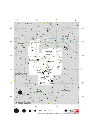
Orion Constellation Map

Caption: The constellation Orion along with its bright stars and surrounding constellations. Orion is surrounded by (going clockwise from the top) Taurus, Eridanus, Lepus, Monoceros and Gemini. Orion’s brightest stars Betelgeuse and Rigel appear at the northern (upper on this diagram) and southern (lower) end of the constellation respectively with the famous three star “belt” in the middle. Orion spans the celestial equator and is thus visible at some time in the year from all of planet Earth. In the most arctic or antarctic regions of the world, some parts of the constellation may not be visible. Orion is most visible in the evenings in the northern hemisphere winter and southern hemisphere summer. The blue line above Orion marks the ecliptic, the path the Sun appears to travel across the sky over the course of a year. The Sun never passes through Orion, but one can occasionally find the other planets of the Solar System and the Moon in Orion. Just south of Orion’s belt lie two Messier objects M42 (the Orion nebula) and M43, marked by green squares. These nebulae along with M78 (here the green square to the left of the belt) are part of the huge Orion Molecular Cloud Complex. This covers most of the constellation and includes regions where these molecular clouds are collapsing to form young starts. The y-axis of this diagram is in degrees of declination with north as up and the x-axis is in hours of right ascension with east to the left. The sizes of the stars marked here relate to the star's apparent magnitude, a measure of its apparent brightness. The larger dots represent brighter stars. The Greek letters mark the brightest stars in the constellation. These are ranked by brightness with the brightest star being labeled alpha, the second brightest beta, etc., although this ordering is not always followed exactly. The circle around Betelgeuse indicates that it is a variable star. The dotted boundary lines mark the IAU's boundaries of the constellations and the solid green lines mark one of the common forms used to represent the figures of the constellations. Neither the constellation boundaries, nor the line marking the ecliptic, nor the lines joining the stars appear on the sky.
Credit: Adapted by the IAU Office of Astronomy for Education from the original by IAU/Sky & Telescope

License: CC-BY-4.0 Creative Commons Attribution 4.0 International (CC BY 4.0) icons


Libra appears as a triangle pointing north (up) with two lines hanging down. It is bisected by the ecliptic running ESE-WNW

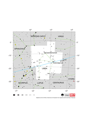
Libra Constellation Map

Caption: The constellation Libra along with its bright stars and surrounding constellations. Libra is surrounded by (going clockwise from the top) Serpens Caput, Virgo, Hydra, Centaurus, Lupus, Scorpius and Ophiuchus. Libra lies on the ecliptic (shown here as a blue line), this is the path the Sun appears to take across the sky over the course of a year. The Sun is in Libra from late October to late November. The other planets of the Solar System can often be found in Libra. Libra lies just south of the celestial equator and is thus visible at some time in all but the most arctic regions. Libra is most visible in the evenings in the northern hemisphere late spring/early summer and southern hemisphere late autumn/early winter. The y-axis of this diagram is in degrees of declination with north as up and the x-axis is in hours of right ascension with east to the left. The sizes of the stars marked here relate to the star's apparent magnitude, a measure of its apparent brightness. The larger dots represent brighter stars. The Greek letters mark the brightest stars in the constellation. These are ranked by brightness with the brightest star being labeled alpha, the second brightest beta, etc., although this ordering is not always followed exactly. The dotted boundary lines mark the IAU's boundaries of the constellations and the solid green lines mark one of the common forms used to represent the figures of the constellations. Neither the constellation boundaries, nor the line marking the ecliptic, nor the lines joining the stars appear on the sky.
Credit: Adapted by the IAU Office of Astronomy for Education from the original by IAU/Sky & Telescope

License: CC-BY-4.0 Creative Commons Attribution 4.0 International (CC BY 4.0) icons


Scorpius appears as a letter T joined to a letter J. The ecliptic runs ESE to WNW and clips one arm of the T

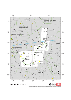
Scorpius Constellation Map

Caption: The constellation Scorpius (often commonly called Scorpio) along with its bright stars and surrounding constellations. Scorpius is surrounded by (going clockwise from the top) Ophiuchus, Serpens Caput, Libra, Lupus, Norma, Ara, Corona Australis and Sagittarius. Scorpius’s brightest star Antares appears in the heart of the constellation with the famous tail of Scoprius in the south-east (lower left). Scorpius lies on the ecliptic (shown here as a blue line), this is the path the Sun appears to take across the sky over the course of a year. The Sun only spends a short amount of time in late November in Scorpius. The other planets of the Solar System can often be found in Scorpius. Scorpius lies south of the celestial equator. The whole constellation is not visible from the most arctic regions of the world with parts of Scorpius obscured for observers in northern parts of Asia, Europe and North America. Scorpius is most visible in the evenings in the northern hemisphere summer and southern hemisphere winter. The yellow circles mark the positions of the open clusters M6, M7 & NGC 6231 while the yellow circles with plus signs superimposed on them mark the globular clusters M4 and M80. The y-axis of this diagram is in degrees of declination with north as up and the x-axis is in hours of right ascension with east to the left. The sizes of the stars marked here relate to the star's apparent magnitude, a measure of its apparent brightness. The larger dots represent brighter stars. The Greek letters mark the brightest stars in the constellation. These are ranked by brightness with the brightest star being labeled alpha, the second brightest beta, etc., although this ordering is not always followed exactly. The circle around Antares indicates that it is a variable star. The dotted boundary lines mark the IAU's boundaries of the constellations and the solid green lines mark one of the common forms used to represent the figures of the constellations. The blue line marks the ecliptic, the path the Sun appears to travel across the sky over the course of one year. Neither the constellation boundaries, nor the line marking the ecliptic, nor the lines joining the stars appear on the sky.
Credit: Adapted by the IAU Office of Astronomy for Education from the original by IAU/Sky & Telescope

License: CC-BY-4.0 Creative Commons Attribution 4.0 International (CC BY 4.0) icons