Glossary term: 日晷
Description: 长期以来,人们一直用太阳在天空中的位置来定义时间,当地正午是太阳在地平线以上的最高点,狭义的一天指日出与日落之间的时间段,而广义上的一天则是指一个当地正午和下一个当地正午之间的时间段。日晷是一种将太阳的方向投射到带有标记的晷面的设备,通常是通过追踪被称为“晷针”的细长指针的阴影来实现定义时间。例如,当影子指向“12”的标记时,读出的时间为 12 点。简单的日晷只能显示太阳时,它与太阳在天空中的位置直接相关,更复杂的日晷则可以测定平均太阳时。
Related Terms:
See this term in other languages
Term and definition status: The original definition of this term in English have been approved by a research astronomer and a teacher The translation of this term and its definition is still awaiting approval
The OAE Multilingual Glossary is a project of the IAU Office of Astronomy for Education (OAE) in collaboration with the IAU Office of Astronomy Outreach (OAO). The terms and definitions were chosen, written and reviewed by a collective effort from the OAE, the OAE Centers and Nodes, the OAE National Astronomy Education Coordinators (NAECs) and other volunteers. You can find a full list of credits here. All glossary terms and their definitions are released under a Creative Commons CC BY-4.0 license and should be credited to "IAU OAE".
If you notice a factual or translation error in this glossary term or definition then please get in touch.
Related Activities
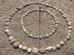
Making a Sundial
astroEDU educational activity (links to astroEDU website) Description: Build a sundial and discover how time can be measured.
License: CC-BY-4.0 Creative Commons 署名 4.0 国际 (CC BY 4.0) icons
Tags:
Hands-on
, Measurement
, Measure
, History
, Clocks
Age Ranges:
6-8
, 8-10
, 10-12
Education Level:
Middle School
, Primary
Areas of Learning:
Modelling
, Observation based
, Social Research
Costs:
Medium Cost
Duration:
1 hour
Group Size:
Group
Skills:
Analysing and interpreting data
, Asking questions
, Communicating information
, Developing and using models

Navigate like a Viking – Use the Sun, not your phone!
astroEDU educational activity (links to astroEDU website) Description: Learn how the Vikings used the sky to navigate at sea with a hands-on activity!
License: CC-BY-4.0 Creative Commons 署名 4.0 国际 (CC BY 4.0) icons
Tags:
History
, Geography
, Maps
, Coordinates
, Celestial navigation
Age Ranges:
12-14
, 14-16
Education Level:
Middle School
Areas of Learning:
Discussion Groups
, Modelling
, Social Research
Costs:
Medium Cost
Duration:
1 hour 30 mins
Group Size:
Group
Skills:
Analysing and interpreting data
, Asking questions
, Communicating information
, Developing and using models
, Planning and carrying out investigations
, Using mathematics and computational thinking