Glossary term: Celestial Coordinates
Description: From Earth, we perceive celestial objects as being located on a sphere, traditionally called the celestial sphere. We can describe any position on that sphere using two numbers. Every method for assigning two such numbers to a sky position is called a celestial coordinate system, and the numbers are called the object's (celestial) coordinates.
On Earth's surface, we use geographical latitude and longitude for the same purpose, and in fact one way of defining celestial coordinates is derived from that: those points in the sky that are directly above Earth's equator form the celestial equator, and the point directly above a certain location on Earth's globe is assigned numbers in a way similar to the latitude/longitude of the base point.
Astronomers use different kinds of coordinate systems, including a number that takes into account Earth's daily rotation, so the coordinates are universal and are usable anywhere on Earth. This also ensures that the coordinates of, say, a star do not change significantly over timescales of days, months, or years.
Related Terms:
See this term in other languages
Term and definition status: This term and its definition have been approved by a research astronomer and a teacher
The OAE Multilingual Glossary is a project of the IAU Office of Astronomy for Education (OAE) in collaboration with the IAU Office of Astronomy Outreach (OAO). The terms and definitions were chosen, written and reviewed by a collective effort from the OAE, the OAE Centers and Nodes, the OAE National Astronomy Education Coordinators (NAECs) and other volunteers. You can find a full list of credits here. All glossary terms and their definitions are released under a Creative Commons CC BY-4.0 license and should be credited to "IAU OAE".
If you notice a factual error in this glossary definition then please get in touch.
Related Diagrams
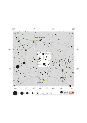
Crux Constellation Map
Credit: Adapted by the IAU Office of Astronomy for Education from the original by IAU/Sky & Telescope.
License: CC-BY-4.0 Creative Commons Attribution 4.0 International (CC BY 4.0) icons
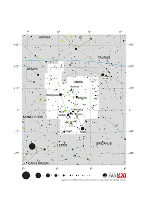
Orion Constellation Map
Credit: Adapted by the IAU Office of Astronomy for Education from the original by IAU/Sky & Telescope
License: CC-BY-4.0 Creative Commons Attribution 4.0 International (CC BY 4.0) icons
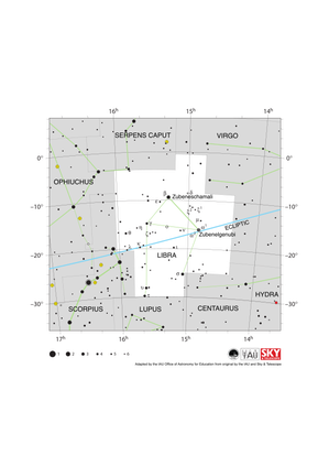
Libra Constellation Map
Credit: Adapted by the IAU Office of Astronomy for Education from the original by IAU/Sky & Telescope
License: CC-BY-4.0 Creative Commons Attribution 4.0 International (CC BY 4.0) icons
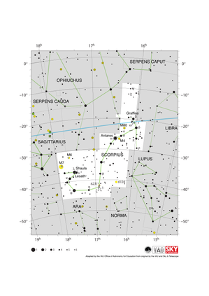
Scorpius Constellation Map
Credit: Adapted by the IAU Office of Astronomy for Education from the original by IAU/Sky & Telescope
License: CC-BY-4.0 Creative Commons Attribution 4.0 International (CC BY 4.0) icons
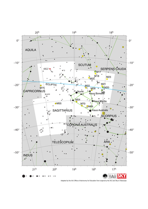
Sagittarius Constellation Map
Credit: Adapted by the IAU Office of Astronomy for Education from the original by IAU/Sky & Telescope
License: CC-BY-4.0 Creative Commons Attribution 4.0 International (CC BY 4.0) icons
Related Activities

Navigation in the Ancient Mediterranean and Beyond
astroEDU educational activity (links to astroEDU website) Description: Learn the ancient skill of Celestial Navigation
License: CC-BY-4.0 Creative Commons Attribution 4.0 International (CC BY 4.0) icons
Tags:
History
, Geography
, Celestial navigation
Age Ranges:
14-16
, 16-19
Education Level:
Middle School
, Secondary
Areas of Learning:
Discussion Groups
, Modelling
, Social Research
Costs:
Low Cost
Duration:
1 hour 30 mins
Group Size:
Group
Skills:
Analysing and interpreting data
, Asking questions
, Communicating information
, Developing and using models
, Planning and carrying out investigations
, Using mathematics and computational thinking