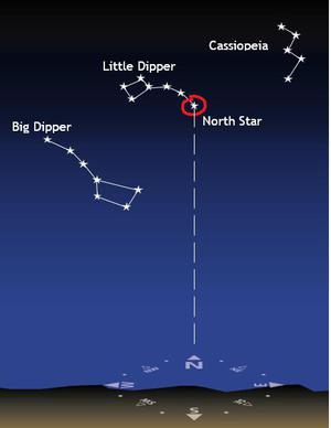
Glossary term: Latitude
Description: Earth is a sphere. To define locations on Earth two sets of imaginary lines are drawn onto the surface of the sphere: Lines of latitude are circles which run around Earth parallel to the equator. The equator has a latitude of 0 degrees. Latitudes in the northern hemisphere are positive; latitudes in the southern hemisphere are negative. The North and South Poles have the highest/lowest latitudes. The North Pole is at +90 degrees and the South Pole at -90 degrees. There are also lines running in great circles through the poles. These are lines of longitude.
Related Terms:
See this term in other languages
Term and definition status: This term and its definition have been approved by a research astronomer and a teacher
The OAE Multilingual Glossary is a project of the IAU Office of Astronomy for Education (OAE) in collaboration with the IAU Office of Astronomy Outreach (OAO). The terms and definitions were chosen, written and reviewed by a collective effort from the OAE, the OAE Centers and Nodes, the OAE National Astronomy Education Coordinators (NAECs) and other volunteers. You can find a full list of credits here. All glossary terms and their definitions are released under a Creative Commons CC BY-4.0 license and should be credited to "IAU OAE".
If you notice a factual error in this glossary definition then please get in touch.
In Other Languages
- Arabic: خط العرض
- German: Breitengrad
- Spanish: Latitud
- French: Latitude
- Italian: Latitudine
- Korean: 위도
- Brazilian Portuguese: Latitude
- Simplified Chinese: 纬度
- Traditional Chinese: 緯度
Related Diagrams

Latitude and Longitude
Caption: Two views of the Earth, one viewing the Northern Hemisphere, one viewing the Southern Hemisphere. The Earth rotates around its axis, an imaginary line that runs through the Earth from the North Pole to the South Pole. The Equator is an imaginary line that is the same distant from both the North Pole and the South Pole.
The positions of two cities, Rome in the Northern Hemisphere and Sydney in the Southern Hemisphere are marked here with red dots. Arrows indicate the two spherical coordinates latitude and longitude.
Latitude marks the position north or south of the equator. Here we can see Rome has the letter N in its latitude as it is in the Northern Hemisphere and Sydney has the letter S in its latitude as it is in the Southern Hemisphere. Latitude can vary from 90° N at the North Pole to 0° at the Equator to 90° S at the South Pole.
Longitude measures the position around the equator. While the choice of the zero point for latitude as the equator seems obvious, the choice of the zero point for longitude is more subjective. By convention the zero point in longitude is the prime meridian which passes through the Royal Greenwich Observatory in the UK. This is marked here as a solid line originating at the North Pole. Longitude is measured in degrees east or west of the prime meridian. As both Rome and Sydney lie to the east of Greenwich, they have the letter E as part of their longitude. Moving west to east, longitude varies from 180° W on the other side of the world from the prime meridian to 0° on the prime meridian before reaching 180° E again on the other side of world from the prime meridian.
This diagram shows the Earth at the December solstice. Two views are presented, one viewing the Northern Hemisphere and one viewing the Southern Hemisphere about nine hours later. The shaded region shows the night side of the Earth, with the day side being lighter. As it is the December solstice, the Sun appears overhead at the Tropic of Capricorn. This is a line of constant latitude at 23°26′09.3″ S. Six months later, at the June solstice, the Sun will appear to be overhead at the Tropic of Cancer at 23°26′09.3″ N. As the Sun appears over the Tropic of Capricorn more of the Southern Hemisphere is illuminated than the Northern Hemisphere. Indeed below the Antarctic Circle (the Polar Circle around the South Pole) the Sun does not set at this time of year leading to a Polar Day. Conversely, north of the Arctic Circle (the Polar Circle around the North Pole) the Sun does not rise at this time of year, leading to a Polar Night.
Credit: Maria Cristina Fortuna/IAU OAE
License: CC-BY-4.0 Creative Commons Attribution 4.0 International (CC BY 4.0) icons
Related Activities

Let's Map the Earth
astroEDU educational activity (links to astroEDU website) Description: Discover how to read and draw maps by observing.
License: CC-BY-4.0 Creative Commons Attribution 4.0 International (CC BY 4.0) icons
Tags:
Hands-on
, Scales
, Geography
, Maps
, GPS
, Coordinates
Age Ranges:
8-10
, 10-12
Education Level:
Primary
Areas of Learning:
Modelling
, Social Research
Costs:
Low Cost
Duration:
1 hour
Group Size:
Group
Skills:
Analysing and interpreting data
How To Travel on Earth Without Getting Lost
astroEDU educational activity (links to astroEDU website) Description: Use a globe to describe your position on Earth.
License: CC-BY-4.0 Creative Commons Attribution 4.0 International (CC BY 4.0) icons
Tags:
Geography
, Maps
, GPS
, Celestial navigation
Age Ranges:
8-10
, 10-12
, 12-14
Education Level:
Middle School
, Primary
Areas of Learning:
Social Research
Costs:
Low Cost
Duration:
1 hour
Group Size:
Group
Skills:
Analysing and interpreting data
, Developing and using models
, Using mathematics and computational thinking

