Glossary term: Declination
Description: In equatorial coordinate systems, declination is one of two coordinates used to specify an object's position in the sky. Specifically, declination is the angular distance of the object to the celestial equator, commonly measured in degrees: positive for objects in the northern hemisphere, with a minus sign for objects in the southern hemisphere. In this way, declination is analogous to geographic latitude on Earth's surface. The celestial equator roughly corresponds to the projection of Earth's equator onto the celestial sphere, but modern coordinate systems like the International Celestial Reference System (ICRS) instead define the celestial equator without reference to the Earth, using the positions of very distant celestial objects in the sky for reference.
Related Terms:
See this term in other languages
Term and definition status: This term and its definition have been approved by a research astronomer and a teacher
The OAE Multilingual Glossary is a project of the IAU Office of Astronomy for Education (OAE) in collaboration with the IAU Office of Astronomy Outreach (OAO). The terms and definitions were chosen, written and reviewed by a collective effort from the OAE, the OAE Centers and Nodes, the OAE National Astronomy Education Coordinators (NAECs) and other volunteers. You can find a full list of credits here. All glossary terms and their definitions are released under a Creative Commons CC BY-4.0 license and should be credited to "IAU OAE".
If you notice a factual error in this glossary definition then please get in touch.
Related Diagrams
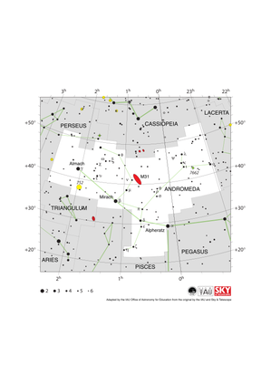
Andromeda Constellation Map
Credit: Adapted by the IAU Office of Astronomy for Education from the original by IAU/Sky & Telescope
License: CC-BY-4.0 Creative Commons Attribution 4.0 International (CC BY 4.0) icons
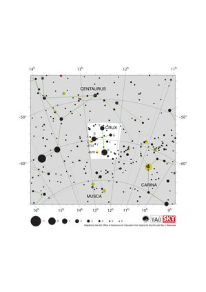
Crux Constellation Map
Credit: Adapted by the IAU Office of Astronomy for Education from the original by IAU/Sky & Telescope.
License: CC-BY-4.0 Creative Commons Attribution 4.0 International (CC BY 4.0) icons
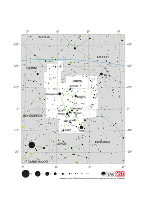
Orion Constellation Map
Credit: Adapted by the IAU Office of Astronomy for Education from the original by IAU/Sky & Telescope
License: CC-BY-4.0 Creative Commons Attribution 4.0 International (CC BY 4.0) icons
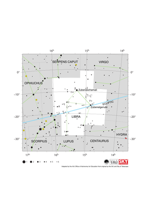
Libra Constellation Map
Credit: Adapted by the IAU Office of Astronomy for Education from the original by IAU/Sky & Telescope
License: CC-BY-4.0 Creative Commons Attribution 4.0 International (CC BY 4.0) icons
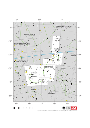
Scorpius Constellation Map
Credit: Adapted by the IAU Office of Astronomy for Education from the original by IAU/Sky & Telescope
License: CC-BY-4.0 Creative Commons Attribution 4.0 International (CC BY 4.0) icons
