Glossarbegriffe: Breitengrad
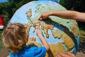
Description: Die Erde ist eine Kugel. Um Orte auf der Erde zu definieren, werden zwei Gruppen von gedachten Linien auf die Oberfläche der Kugel gezeichnet: Die Breitengradlinien sind Kreise, die parallel zum Äquator um die Erde verlaufen. Der Äquator hat eine geographische Breite von 0 Grad. Breitengrade auf der Nordhalbkugel sind positiv, Breitengrade auf der Südhalbkugel sind negativ. Der Nordpol und der Südpol haben die höchsten bzw. niedrigsten Breitengrade. Der Nordpol liegt bei +90 Grad und der Südpol bei -90 Grad. Es gibt auch Linien, die in Großkreisen durch die Pole verlaufen. Diese Linien sind die Längengrade.
Zugehörige Glossarbegriffe:
See this term in other languages
Term and definition status: The original definition of this term in English have been approved by a research astronomer and a teacher The translation of this term and its definition is still awaiting approval
The OAE Multilingual Glossary is a project of the IAU Office of Astronomy for Education (OAE) in collaboration with the IAU Office of Astronomy Outreach (OAO). The terms and definitions were chosen, written and reviewed by a collective effort from the OAE, the OAE Centers and Nodes, the OAE National Astronomy Education Coordinators (NAECs) and other volunteers. You can find a full list of credits here. All glossary terms and their definitions are released under a Creative Commons CC BY-4.0 license and should be credited to "IAU OAE".
If you notice a factual or translation error in this glossary term or definition then please get in touch.
Related Activities
Let's Map the Earth
astroEDU educational activity (links to astroEDU website) Description: Discover how to read and draw maps by observing.
License: CC-BY-4.0 Creative Commons Namensnennung 4.0 International (CC BY 4.0) icons
Tags:
Hands-on
, Scales
, Geography
, Maps
, GPS
, Coordinates
Age Ranges:
8-10
, 10-12
Education Level:
Primary
Areas of Learning:
Modelling
, Social Research
Costs:
Low Cost
Duration:
1 hour
Group Size:
Group
Skills:
Analysing and interpreting data
How To Travel on Earth Without Getting Lost
astroEDU educational activity (links to astroEDU website) Description: Use a globe to describe your position on Earth.
License: CC-BY-4.0 Creative Commons Namensnennung 4.0 International (CC BY 4.0) icons
Tags:
Geography
, Maps
, GPS
, Celestial navigation
Age Ranges:
8-10
, 10-12
, 12-14
Education Level:
Middle School
, Primary
Areas of Learning:
Social Research
Costs:
Low Cost
Duration:
1 hour
Group Size:
Group
Skills:
Analysing and interpreting data
, Developing and using models
, Using mathematics and computational thinking
