Glossar-Begriff: Azimut
Beschreibung: In einem horizontalen Koordinatensystem bezieht sich der (oder das) Azimut auf die Richtung (Winkel entlang des Horizonts), in der sich das Objekt befindet. Er wird in Grad gemessen, ausgehend von Norden (Nordpunkt) und in Richtung Osten (Uhrzeigersinn). Werte für den Azimut decken einen Vollkreis von 0 Grad bis 360 Grad ab. Anders ausgedrückt: Wenn du auf der Himmelskugel einen gedachten Bogen vom Objekt zum Horizont senkrecht zum Horizont zeichnest, gibt der Azimut die Position des Punktes an, an dem dieser Bogen den Horizont schneidet. Ein Objekt, das sich direkt im Norden befindet, hat einen Azimut von 0 Grad. Ein Objekt, das sich genau im Osten befindet, hat einen Azimut von 90 Grad und so weiter. Teilweise war es früher üblich, den Azimut ausgehend von Süden nach Westen zu messen. Deshalb wären nach dieser Konvention die Azimutwerte um 180 Grad verschoben.
Ähnliche Begriffe:
Dieser Begriff in anderen Sprachen
Begriffs- und Definitionsstatus Die Originaldefinition dieses Begriffes auf Englisch wurden von einem forschenden Astronom und einer Lehrkraft bestätigt Die Übersetzung dieses Begriffs und seiner Definition warten auf Prüfung und Bestätigung
The OAE Multilingual Glossary is a project of the IAU Office of Astronomy for Education (OAE) in collaboration with the IAU Office of Astronomy Outreach (OAO). The terms and definitions were chosen, written and reviewed by a collective effort from the OAE, the OAE Centers and Nodes, the OAE National Astronomy Education Coordinators (NAECs) and other volunteers. You can find a full list of credits here. All glossary terms and their definitions are released under a Creative Commons CC BY-4.0 license and should be credited to "IAU OAE".
Wenn dir ein inhaltlicher oder Übersetzungsfehler in diesem Glossarbegriff oder dieser Definition auffallen, bitte kontaktiere uns.
Ähnliche Diagramme

Horizontal Coordinate System
Unterschrift: This image shows the horizontal coordinate system of an observer on Earth. On the right we see the coordinate system in the local context of the observer. The observer appears here as a point surrounded by the celestial sphere. The ground appears as a plane, while the Earth is round, we can approximate the ground in the area around the observer as a plane. The line where this plane intersects with the celestial sphere is the horizon. The point directly above the observer is the zenith, the point directly below the observer is the nadir which is hidden by the ground.
Two coordinates define this coordinate system, altitude and azimuth, hence the reason this sometimes called an alt-az coordinate system. The altitude is zero at the horizon, maximum (90°) at the zenith and minimum (-90°) at the nadir. Azimuth is the angle around the horizon. Most commonly this is defined to be zero in the direction of north. Any point on the celestial sphere can be defined by these two coordinates. However what objects appear on these position will depend on the time and the location of the observer.
On the left-hand part of the diagram, we can see that when we put the observer and their local horizontal coordinate system in a global context, that the parts of the sky the observer can see depend on their position on the Earth and on the rotation of the Earth. The zenith points perpendicular to the Earth's surface so the position on the sky the zenith and nadir correspond to is dependent on the observer's latitude. The horizon also depends on the observer's position on the Earth.
Bild: Maria Cristina Fortuna/IAU OAE
License: CC-BY-4.0 Creative Commons Namensnennung 4.0 International (CC BY 4.0) Symbole
Ähnliche Aktivitäten
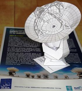
Das Projekt ALMA Mater
astroEDU educational activity (links to astroEDU website) Description: Im folgenden WIS-Beitrag wollen wir eines der ALMA-Radioteleskope detaillierter betrachten. Aus-gehend vom anfassbaren Papiermodell werden wir prinzipielle Anforderungen an die wesentlichen Teleskopkomponenten näher kennenlernen, wobei der Schwerpunkt auf Sammlung, Weiterleitung und Detektion der Radiostrahlung liegt. Das Ziel ist, die vorgenannten Aspekte mit Schulinhalten zu verbinden und jeweils mit einer Vielzahl von Aktivitäten für Schüler nachvollziehbarer zu gestalten (sehr gut für Projekte geeignet). Das Aktivitätsspektrum reicht dabei von Aufgaben verschiedener Gattungen und Schwierigkeitsgrade sowie mit Bezügen zu verschiedenen Fächern über Experimente bis hin zu Selbstbauanleitungen.
Altersgruppen: 14-16 Bildungsniveau: Secondary
Himmelsteleskope
astroEDU educational activity (links to astroEDU website) Description: Der wissbegierige Schüler Daniel möchte mehr darüber wissen, was die verschiedenen astronomischen Teleskoptypen voneinander unterscheidet. Im Gespräch mit dem Studenten Jan verschafft er sich darüber Klarheit. Jan zeigt ihm auch, wie er schon mit seinem Schulwissen von der geometrischen Optik manches Problem lösen kann.
Altersgruppen: 16-19 Bildungsniveau: Secondary
