Glossary term: El eje de rotación de la Tierra
Description: El eje de rotación de la Tierra es una línea recta imaginaria que atraviesa el planeta y alrededor de la cual la Tierra gira sobre sí misma una vez al día. Los dos puntos en los que este eje cruza la superficie terrestre son el Polo Norte geográfico (a una latitud de 90° N) y el Polo Sur geográfico (a una latitud de 90° S). Por el contrario, el ecuador es una circunferencia imaginaria en la que un plano perpendicular al eje de la Tierra se cruza con la superficie terrestre en el punto más alejado del eje de rotación. Al ecuador se le asigna la latitud de 0°.
Los polos geográficos no coinciden con los polos norte y sur magnéticos de la Tierra. Los polos magnéticos son los puntos de la superficie terrestre en los que el campo magnético de la Tierra apunta directamente hacia abajo y hacia arriba, respectivamente.
El eje de rotación de la Tierra está inclinado un ángulo de 23,4º respecto al eje perpendicular al plano orbital de la Tierra. Esta inclinación es la responsable de la existencia de las estaciones terrestres; puesto que, durante una órbita alrededor del Sol, hay fases en las que el hemisferio norte o el sur se inclinan hacia el Sol, recibiendo así más luz.
Si tenemos en cuenta los objetos celestes más lejanos, la dirección hacia la que apunta el eje de la Tierra cambia lentamente con el tiempo, describiendo, lo largo de unos 26 000 años, un pequeño círculo en el cielo A este movimiento se le denomina precesión axial de la Tierra. Actualmente, el eje de la Tierra corta la esfera celeste cerca de Polaris, la Estrella Polar. Estos minúsculos desplazamientos de coordenadas resultantes a lo largo del tiempo deben de ser tenidos en cuenta por los sistemas de coordenadas celestes que definen las coordenadas del cielo con referencia a la Tierra.
Related Terms:
See this term in other languages
Term and definition status: The original definition of this term in English have been approved by a research astronomer and a teacher The translation of this term and its definition is still awaiting approval
The OAE Multilingual Glossary is a project of the IAU Office of Astronomy for Education (OAE) in collaboration with the IAU Office of Astronomy Outreach (OAO). The terms and definitions were chosen, written and reviewed by a collective effort from the OAE, the OAE Centers and Nodes, the OAE National Astronomy Education Coordinators (NAECs) and other volunteers. You can find a full list of credits here. All glossary terms and their definitions are released under a Creative Commons CC BY-4.0 license and should be credited to "IAU OAE".
If you notice a factual or translation error in this glossary term or definition then please get in touch.
In Other Languages
- Árabe: محور الأرض
- Alemán: Erdachse
- Inglés: Earth's Axis
- Francés: Axe de la Terre
- Italiano: Asse terrestre
- Portugués de Brasil: Eixo da Terra
- Chino simplificado: 地轴
- Chino tradicional: 地軸
Related Diagrams

Latitud y longitud
Caption: Dos vistas de la Tierra, una del hemisferio norte y otra del hemisferio sur. La Tierra rota alrededor de su eje, una línea imaginaria que la atraviesa desde el polo norte hasta el polo sur. El ecuador es una línea imaginaria que está a la misma distancia del polo norte que del polo sur.
Las posiciones de dos ciudades, Roma en el hemisferio norte y Sídney en el hemisferio sur, están marcadas aquí con puntos rojos. Las flechas indican las dos coordenadas esféricas: latitud y longitud.
La latitud marca la posición al norte o al sur del ecuador. Aquí podemos ver que Roma tiene la letra N en su latitud, puesto que se encuentra en el hemisferio norte, y Sídney tiene la letra S en su latitud, ya que se encuentra en el hemisferio sur. La latitud puede variar desde los 90° N en el polo norte, los 0° en el ecuador y hasta los 90° S en el polo sur.
La longitud mide la posición en torno al ecuador. Mientras que la elección del punto cero para la latitud en el ecuador parece obvia, la elección del punto cero para la longitud es más subjetiva. Por convenio, el punto cero en longitud es el meridiano principal que pasa por el Observatorio Real de Greenwich en el Reino Unido. Aquí se marca como una línea continua que parte del polo norte. La longitud se mide en grados al este o al oeste del meridiano de referencia. Dado que tanto Roma como Sídney se encuentran al este de Greenwich, tienen la letra E como parte de su longitud. De oeste a este, la longitud varía desde los 180° O, al otro lado del mundo respecto al meridiano de referencia, los 0° en ese meridiano, hasta alcanzar de nuevo los 180° E al otro lado del mundo respecto al meridiano de referencia.
Este diagrama muestra la Tierra en el solsticio de diciembre. Se presentan dos vistas, una del hemisferio norte y otra del hemisferio sur, unas nueve horas más tarde. La región sombreada muestra el lado nocturno de la Tierra, mientras que el lado diurno es más claro. Al ser el solsticio de diciembre, el Sol se encuentra en su punto más alto sobre el Trópico de Capricornio. Esta es una línea de latitud constante a 23°26′09,3″ S. Seis meses más tarde, en el solsticio de junio, el Sol parecerá estar en su punto más alto sobre el Trópico de Cáncer, a 23°26′09,3″ N. Cuando el Sol se eleva sobre el Trópico de Capricornio, se ilumina una mayor parte del hemisferio sur que del hemisferio norte. De hecho, por debajo del círculo antártico (el círculo polar alrededor del polo sur), el Sol no se pone en esta época del año, lo que da lugar a un día polar. Por el contrario, al norte del círculo ártico (el círculo polar alrededor del polo norte), el Sol no sale en esta época del año, lo que da lugar a una noche polar.
Credit: María Cristina Fortuna/IAU OAE
License: CC-BY-4.0 Creative Commons Reconocimiento 4.0 Internacional (CC BY 4.0) icons

Solstices and Equinoxes
Caption: This diagram demonstrates the relative positions of the Earth and Sun at the two solstices and two equinoxes. The Earth’s rotation axis is tilted by 23.4° from the axis of its orbit. This means that for half the Earth’s annual orbit around the Sun, the Southern Hemisphere is tilted towards the Sun and the Northern Hemisphere is tilted away from the Sun. During this time the Sun appears to lie below the celestial equator. Due to this at any particular point in the Southern Hemisphere the Sun will appear to be higher above the horizon at a particular time of day and the days will be longer. Conversely during this time, the Sun appears lower in the sky at any particular point in the day in the Northern Hemisphere and the days are shorter.
This effect is most pronounced in late December when the Sun appears at its most southerly point in the sky, corresponding to the longest day of the year in the Southern Hemisphere. This normally occurs on the 21st or 22nd of December (UTC), depending on when the most recent leap year was, but can very occasionally occur on the 20th or 23rd of December. This event is known as the December solstice. As the Sun’s rays hit the Southern Hemisphere at a more perpendicular angle during this time, the Southern Hemisphere is typically warmer in this time of year than at other times of year. This is often referred to as summer in temperate and antarctic regions of the Southern Hemisphere and thus the December solstice is known as the summer solstice. South of the Antarctic Circle at this time the Sun never sets and a Polar Day can last several months. Conversely in the Northern Hemisphere, the Sun’s rays hit the Earth at a more grazing angle than at other times of year so it is colder and this solstice is known as the winter solstice. North of the Arctic Circle the Sun never rises during this time and the Polar Night can last several months.
As the year progresses the Earth moves in its orbit and the tilt of the Earth’s axis moves so it appears more side-on to the Sun. From the perspective of an observer on Earth this means that the Sun moves north in the sky, eventually reaching the celestial equator in late March, This usually occurs on the 20th of March (UTC) but can sometimes occur on the 19th or 21st of March. During this time all places on Earth will experience night and day that is approximately 12 hours long. The Sun’s rays now hit the Southern hemisphere at a more shallow angle than they did in December and hit the Northern Hemisphere at a more perpendicular angle. This means that the Northen Hemisphere will have warmed since December and the Southern Hemisphere cooled. This leads to the March equinox being referred to as the autumn equinox in the Southern Hemisphere and the spring or vernal equinox in the Northern Hemisphere.
As the year progresses further the Sun moves further north on the sky, the Northern Hemisphere days lengthen and the Southern Hemisphere days shorten. By June the Earth’s orbit has progressed to the point where the Northern Hemisphere points towards the Sun and the Southern Hemisphere away from the Sun. At one point between the 20th and 22nd of June (UTC) the Sun reaches its most northerly point in the sky, this is known as June solstice. It is now summer in northern temperate and artic regions so this is known as the summer solstice in the Northern Hemisphere and the winter solstice in the Southern Hemisphere. This is the longest day of the year in the Northern Hemisphere and the shortest day of the year in the Southern Hemisphere. During this time regions north of the Arctic Circle experience a long Polar Day and regions south of the Antarctic Circle experience polar night.
The year progresses further and the Earth moves in its orbit so that the tilt of the Earth’s axis again appears side-on for the Sun. The Sun moves south in the sky and again crosses the celestial equator between the 21st and 24th of September (UTC). At this time all places on the Earth experience equal lengths of day and night. This is known as the September equinox, also called the spring or vernal equinox in the Southern Hemisphere and the autumn equinox in the Northern Hemisphere.
Note the sizes of the Earth, Sun and the Earth’s orbit around the Sun are not to scale in this diagram.
Credit: Maria Cristina Fortuna/IAU OAE
License: CC-BY-4.0 Creative Commons Reconocimiento 4.0 Internacional (CC BY 4.0) icons
Related Activities
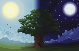
Why Do We Have Day and Night?
astroEDU educational activity (links to astroEDU website) Description: Explore day and night of Earth.
License: CC-BY-4.0 Creative Commons Reconocimiento 4.0 Internacional (CC BY 4.0) icons
Tags:
Tilt
Age Ranges:
6-8
, 8-10
, 10-12
Education Level:
Primary
, Secondary
Areas of Learning:
Modelling
, Simulation focussed
, Structured-inquiry learning
Costs:
Low Cost
Duration:
1 hour 30 mins
Group Size:
Group
Skills:
Asking questions
, Communicating information

