词条 地轴
描述: 地轴是一条假想的直线,地球每天围绕它旋转一圈。地轴与地球表面相交的两个位置是地理北极(北纬 90°)和地理南极(南纬 90°)。与此相对,赤道也是一条假想线,是垂直于地轴的平面与地球表面相交的大圆,与地轴的距离最远。赤道的纬度为 0°。
地理南北极与地球磁场南北极的位置不同--磁极定义为地球表面上地磁场方向竖直向上和竖直向下的点。
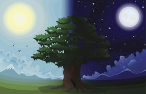
地球公转轨道也有一个轴:方向与地球轨道平面垂直。地轴与轨道轴夹角 23.4°。这一夹角是地球四季变化的原因。特别是,在一个轨道周期中,北半球或南半球会向太阳倾斜,从而接收到更多的光。
相对于最遥远的天体,地轴指向的方向会随着时间的推移而缓慢变化,这就是所谓的岁差(地轴近动)。目前,地轴与天球相交的位置接近北极星。但在大约 2.6 万年的时间里,这个交点会在天空中画出一个小圆圈。以地球为参照定义的天球坐标系需要考虑到由此产生的随时间推移的微小坐标偏移。
相关词条
用其他语言查看该词条
词条和定义状态: 该术语的英文原始定义已通过天文研究人员和教师的审核 该术语及其定义的译文仍待审核
OAE多语言词汇表是由国际天文学联合会(IAU) 天文教育办公室(OAE) 和 国际天文学联合会(IAU) 天文推广办公室(OAO)合作的项目。. 术语和定义由 OAE中心, OAE 国家天文教育协调员(NAECs) 以及其他志愿者共同选择、撰写和审阅。您可以在 找到完整的致谢列表。所有词汇表术语及其定义均根据 Creative Commons CC BY-4.0许可证发布 且版权归属于 “IAU OAE”。
如果您发现此词汇术语或定义中的事实或翻译错误, 请向 发邮件 联系.
其他语言版本
- 阿拉伯语: محور الأرض
- 德语: Erdachse
- 英语: Earth's Axis
- 西班牙语: El eje de rotación de la Tierra
- 法语: Axe de la Terre
- 意大利语: Asse terrestre
- 巴西葡萄牙语: Eixo da Terra
- 繁体中文: 地軸
相关图表

Latitude and Longitude
图注: Two views of the Earth, one viewing the Northern Hemisphere, one viewing the Southern Hemisphere. The Earth rotates around its axis, an imaginary line that runs through the Earth from the North Pole to the South Pole. The Equator is an imaginary line that is the same distant from both the North Pole and the South Pole.
The positions of two cities, Rome in the Northern Hemisphere and Sydney in the Southern Hemisphere are marked here with red dots. Arrows indicate the two spherical coordinates latitude and longitude.
Latitude marks the position north or south of the equator. Here we can see Rome has the letter N in its latitude as it is in the Northern Hemisphere and Sydney has the letter S in its latitude as it is in the Southern Hemisphere. Latitude can vary from 90° N at the North Pole to 0° at the Equator to 90° S at the South Pole.
Longitude measures the position around the equator. While the choice of the zero point for latitude as the equator seems obvious, the choice of the zero point for longitude is more subjective. By convention the zero point in longitude is the prime meridian which passes through the Royal Greenwich Observatory in the UK. This is marked here as a solid line originating at the North Pole. Longitude is measured in degrees east or west of the prime meridian. As both Rome and Sydney lie to the east of Greenwich, they have the letter E as part of their longitude. Moving west to east, longitude varies from 180° W on the other side of the world from the prime meridian to 0° on the prime meridian before reaching 180° E again on the other side of world from the prime meridian.
This diagram shows the Earth at the December solstice. Two views are presented, one viewing the Northern Hemisphere and one viewing the Southern Hemisphere about nine hours later. The shaded region shows the night side of the Earth, with the day side being lighter. As it is the December solstice, the Sun appears overhead at the Tropic of Capricorn. This is a line of constant latitude at 23°26′09.3″ S. Six months later, at the June solstice, the Sun will appear to be overhead at the Tropic of Cancer at 23°26′09.3″ N. As the Sun appears over the Tropic of Capricorn more of the Southern Hemisphere is illuminated than the Northern Hemisphere. Indeed below the Antarctic Circle (the Polar Circle around the South Pole) the Sun does not set at this time of year leading to a Polar Day. Conversely, north of the Arctic Circle (the Polar Circle around the North Pole) the Sun does not rise at this time of year, leading to a Polar Night.
来源: Maria Cristina Fortuna/IAU OAE

Solstices and Equinoxes
图注: This diagram demonstrates the relative positions of the Earth and Sun at the two solstices and two equinoxes. The Earth’s rotation axis is tilted by 23.4° from the axis of its orbit. This means that for half the Earth’s annual orbit around the Sun, the Southern Hemisphere is tilted towards the Sun and the Northern Hemisphere is tilted away from the Sun. During this time the Sun appears to lie below the celestial equator. Due to this at any particular point in the Southern Hemisphere the Sun will appear to be higher above the horizon at a particular time of day and the days will be longer. Conversely during this time, the Sun appears lower in the sky at any particular point in the day in the Northern Hemisphere and the days are shorter.
This effect is most pronounced in late December when the Sun appears at its most southerly point in the sky, corresponding to the longest day of the year in the Southern Hemisphere. This normally occurs on the 21st or 22nd of December (UTC), depending on when the most recent leap year was, but can very occasionally occur on the 20th or 23rd of December. This event is known as the December solstice. As the Sun’s rays hit the Southern Hemisphere at a more perpendicular angle during this time, the Southern Hemisphere is typically warmer in this time of year than at other times of year. This is often referred to as summer in temperate and antarctic regions of the Southern Hemisphere and thus the December solstice is known as the summer solstice. South of the Antarctic Circle at this time the Sun never sets and a Polar Day can last several months. Conversely in the Northern Hemisphere, the Sun’s rays hit the Earth at a more grazing angle than at other times of year so it is colder and this solstice is known as the winter solstice. North of the Arctic Circle the Sun never rises during this time and the Polar Night can last several months.
As the year progresses the Earth moves in its orbit and the tilt of the Earth’s axis moves so it appears more side-on to the Sun. From the perspective of an observer on Earth this means that the Sun moves north in the sky, eventually reaching the celestial equator in late March, This usually occurs on the 20th of March (UTC) but can sometimes occur on the 19th or 21st of March. During this time all places on Earth will experience night and day that is approximately 12 hours long. The Sun’s rays now hit the Southern hemisphere at a more shallow angle than they did in December and hit the Northern Hemisphere at a more perpendicular angle. This means that the Northen Hemisphere will have warmed since December and the Southern Hemisphere cooled. This leads to the March equinox being referred to as the autumn equinox in the Southern Hemisphere and the spring or vernal equinox in the Northern Hemisphere.
As the year progresses further the Sun moves further north on the sky, the Northern Hemisphere days lengthen and the Southern Hemisphere days shorten. By June the Earth’s orbit has progressed to the point where the Northern Hemisphere points towards the Sun and the Southern Hemisphere away from the Sun. At one point between the 20th and 22nd of June (UTC) the Sun reaches its most northerly point in the sky, this is known as June solstice. It is now summer in northern temperate and artic regions so this is known as the summer solstice in the Northern Hemisphere and the winter solstice in the Southern Hemisphere. This is the longest day of the year in the Northern Hemisphere and the shortest day of the year in the Southern Hemisphere. During this time regions north of the Arctic Circle experience a long Polar Day and regions south of the Antarctic Circle experience polar night.
The year progresses further and the Earth moves in its orbit so that the tilt of the Earth’s axis again appears side-on for the Sun. The Sun moves south in the sky and again crosses the celestial equator between the 21st and 24th of September (UTC). At this time all places on the Earth experience equal lengths of day and night. This is known as the September equinox, also called the spring or vernal equinox in the Southern Hemisphere and the autumn equinox in the Northern Hemisphere.
Note the sizes of the Earth, Sun and the Earth’s orbit around the Sun are not to scale in this diagram.
来源: Maria Cristina Fortuna/IAU OAE
相关活动
Why Do We Have Day and Night?
astroEDU educational activity (links to astroEDU website) Description: Explore day and night of Earth.
License: CC-BY-4.0 知识共享许可协议 署名 4.0 国际 (CC BY 4.0) 图标
标签:
Tilt
年龄段:
6-8
, 8-10
, 10-12
受教育等级:
Primary
, 中学
学习领域:
建模
, 以模拟为主
, 结构化探究式学习
费用:
低成本
时间跨度:
1 小时 30 分钟
组别大小:
小组
技能:
提出问题
, 传达信息

