Glossary term: 人造衛星
Description: 人造衛星是一種人造裝置,它被送入太空,繞地球或其他太陽系天體運行,並在引力作用下保持在軌道上。人造衛星可以執行各種任務,包括航拍地球照片,幫助氣象學家預測天氣,或拍攝天體和遙遠星系的照片,幫助科學家更好地了解宇宙系統。人造衛星還主要用於全球通信和定位,如全球定位系統(GPS)。第一顆人造衛星於 1957 年由蘇聯發射升空,被稱為“斯普特尼克”1號。
Related Terms:
See this term in other languages
Term and definition status: The original definition of this term in English have been approved by a research astronomer and a teacher The translation of this term and its definition is still awaiting approval
This is an automated transliteration of the simplified Chinese translation of this term
The OAE Multilingual Glossary is a project of the IAU Office of Astronomy for Education (OAE) in collaboration with the IAU Office of Astronomy Outreach (OAO). The terms and definitions were chosen, written and reviewed by a collective effort from the OAE, the OAE Centers and Nodes, the OAE National Astronomy Education Coordinators (NAECs) and other volunteers. You can find a full list of credits here. All glossary terms and their definitions are released under a Creative Commons CC BY-4.0 license and should be credited to "IAU OAE".
If you notice a factual or translation error in this glossary term or definition then please get in touch.
In Other Languages
- 阿拉伯語: قمر اصطناعي
- 德語: Künstlicher Satellit
- 英語: Artificial Satellite
- 西班牙語: Satélite Artificial
- 法語: Satellite artificiel
- 印地語: कृत्रिम उपग्रह
- 義大利語: Satellite artificiale
- 日語: 人工衛星 (external link)
- 韓語: 인공 위성
- 馬拉提語: कृत्रिम उपग्रह
- 巴西葡萄牙語: Satélite artificial
- 簡體中文: 人造卫星
Related Media
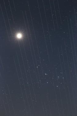
衛星群與夜空之美,作者 Torsten Hansen,德國
Caption: 2021 年國際天文學聯合會 OAE 天文攝影比賽光汙染類第三名。
這幅金星和昴星團的圖像還顯示了星鍊衛星的軌跡。這些衛星位於大約 550 公裡的高空,是不斷擴大的衛星群的一部分,旨在提供全球互聯網接入。衛星的反射表面,以及它們圍繞地球運行,意味著需要長時間曝光的天文觀測會在圖像中捕捉到衛星的 "軌跡"。由於測量結果和數據包含這些 "軌跡",這導致用於科學研究的天文圖像無法使用。衛星的數量預計會不斷增加,在不久的將來,地球上可能再無任何地方能避開這些衛星劃過天空的軌跡。這是一種新型的光汙染,似乎正成為我們即將要面對的問題,因為這些衛星可能會阻礙對天空的最佳觀測。
Credit: Torsten Hansen/IAU OAE
License: CC-BY-4.0 Creative Commons 姓名標示 4.0 國際 (CC BY 4.0) icons
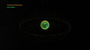
Space debris orbiting the Earth
Caption: This animation shows objects orbiting the Earth. The data date from February 2024 and are taken from space-track.org which maintains a public catalogue of objects tracked by the United States Space Command (USSPACECOM).
At first in this video we see green dots, each representing one of the 31,000 human-made objects orbiting Earth. These include both operational and decommissioned satellites, used rocket stages from space launches, and fragments larger than 10cm created by collisions or explosions. Later in the video, some of the green dots are replace by orange dots, each of these representing one of the 9,300 operational satellites orbiting the Earth. Note that since February 2024 more satellites and rockets have been launched in to space and some objects will have fallen back to Earth, so these numbers will have changed.
We see two main groups of objects. The first are those objects orbiting close to the Earth, objects in low Earth orbit. These include communication satellites (many from the satellite constellations used to provide satellite internet services), Earth observation satellites, military satellites, two operational space stations and other objects such as rocket stages and other debris.
More distant from Earth we see a thin ring of satellites. These are in geostationary orbit. This is a special orbit where the orbital period matches the rotation period of the Earth. This means that a satellite in geostationary orbit stays above the same point on the equator and, when observed from the side of the Earth facing the satellite, will appear to stay at a position on the sky that does not change over time. Because of this, geostationary orbit is used by many communications satellites as a satellite dish on Earth used to receive or transmit a signal to that satellite can point in a fixed direction and does not need to dynamically track the satellite. Geostationary orbit is also used by weather observation satellites.
Credit: NASA's Scientific Visualization Studio
credit link
License: PD Public Domain icons
Related Activities
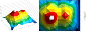
Valleys Deep and Mountains High
astroEDU educational activity (links to astroEDU website) Description: Learn how radar altimetry from satellites works and how to put landscapes on paper.
License: CC-BY-4.0 Creative Commons 姓名標示 4.0 國際 (CC BY 4.0) icons
Tags:
Maps
, Earth observation
, Sentinel
, Copernicus
, Remote sensing
, Altimetry
, Radar
Age Ranges:
14-16
, 16-19
Education Level:
Middle School
, Secondary
Areas of Learning:
Discussion Groups
, Modelling
, Structured-inquiry learning
Costs:
Medium Cost
Duration:
2 hours
Group Size:
Group
Skills:
Analysing and interpreting data
, Asking questions
, Communicating information
, Developing and using models
, Using mathematics and computational thinking
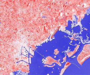
A View from Above
astroEDU educational activity (links to astroEDU website) Description: How do satellites take images of the Earth surface and how do we analyse and use them?
License: CC-BY-4.0 Creative Commons 姓名標示 4.0 國際 (CC BY 4.0) icons
Tags:
Maps
, Climate
, Landsat
, Earth observation
, Sentinel
, Copernicus
, Remote sensing
, Vegetation
Age Ranges:
14-16
, 16-19
Education Level:
Middle School
, Secondary
Areas of Learning:
Structured-inquiry learning
Costs:
Low Cost
Duration:
1 hour 30 mins
Group Size:
Group
Skills:
Analysing and interpreting data
, Asking questions
, Communicating information
, Constructing explanations
, Developing and using models
, Engaging in argument from evidence
, Using mathematics and computational thinking
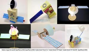
Build Your Own Artificial Satellite
astroEDU educational activity (links to astroEDU website) Description: Build a satellite to learn what they are made of and their uses.
License: CC-BY-4.0 Creative Commons 姓名標示 4.0 國際 (CC BY 4.0) icons
Tags:
Art
, Creativity
, Hands-on
, Model
Age Ranges:
8-10
Education Level:
Primary
Areas of Learning:
Discussion Groups
, Interactive Lecture
, Modelling
Costs:
Low Cost
Duration:
1 hour 30 mins
Group Size:
Group
Skills:
Communicating information
, Developing and using models
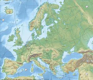
Where on Earth am I?
astroEDU educational activity (links to astroEDU website) Description: How do satellite-based positioning and GPS navigation work?
License: CC-BY-4.0 Creative Commons 姓名標示 4.0 國際 (CC BY 4.0) icons
Tags:
Clocks
, Geography
, Maps
, GPS
, Countries
, Speed of light
, Galileo
Age Ranges:
14-16
Education Level:
Middle School
Areas of Learning:
Guided-discovery learning
, Problem-solving
Costs:
Low Cost
Duration:
1 hour 30 mins
Group Size:
Group
Skills:
Analysing and interpreting data
, Asking questions
, Communicating information
, Constructing explanations
, Developing and using models
, Using mathematics and computational thinking