Termo do glossário: Satélite artificial
Descrição: Um satélite artificial é um dispositivo feito pelo pelo ser humano e enviado ao espaço para orbitar a Terra ou outros objetos do Sistema Solar, onde a gravidade o mantém em órbita. Os satélites artificiais podem ser construídos para executar diversas tarefas, incluindo tirar fotografias aéreas da Terra, que ajudam os meteorologistas a prever o clima ou tirar fotos de corpos astronômicos e galáxias distantes, auxiliando os cientistas a entender melhor o sistema cósmico. Satélites artificiais também são usados principalmente para comunicações e para localização,, por exemplo, o Sistema de Posicionamento Global (GPS). O primeiro satélite artificial foi lançado ao espaço em 1957 pela União Soviética e foi chamado de Sputnik 1.
Termos relacionados:
Ver este termo em outros idiomas
Status do termo e da definição: A definição original deste termo em inglês foi aprovada por um astrônomo(a) pesquisador(a) e um(a) professor(a) A tradução deste termo e de sua definição ainda aguarda aprovação
O Glossário Multilíngue da OAE é um projeto do Escritório da IAU de Astronomia para a Educação (OAE) em colaboração com o Escritório da IAU para Divulgação da Astronomia (OAO). Os termos e definições foram selecionados, escritos e revisados por meio de um esforço coletivo da OAE, dos Centros e Nós da OAE, dos Coordenadores Nacionais de Educação em Astronomia (NAECs) da OAE e de outros voluntários. Você pode encontrar uma lista completa dos créditos aqui. Todos os termos do glossário e suas definições são disponibilizados sob uma licença Creative Commons CC BY-4.0 e devem ser creditados à "IAU OAE".
Se você notar algum erro factual ou de tradução neste termo do glossário ou em sua definição, por favor entre em contato.
Em outros idiomas
- Árabe: قمر اصطناعي
- Alemão: Künstlicher Satellit
- Inglês: Artificial Satellite
- Espanhol: Satélite Artificial
- Francês: Satellite artificiel
- Hindi: कृत्रिम उपग्रह
- Italiano: Satellite artificiale
- Japonês: 人工衛星 (link externo)
- Coreano: 인공 위성
- Marathi: कृत्रिम उपग्रह
- Chinês Simplificado: 人造卫星
- Chinês Tradicional: 人造衛星
Mídia relacionada
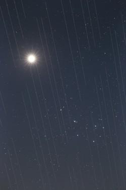
Satellite swarm versus night sky beauty, by Torsten Hansen, Germany
Legenda: Third place in the 2021 IAU OAE Astrophotography Contest, category Light pollution.
This image of Venus and the Pleiades also shows the tracks of the Starlink satellites. These satellites which are located at an altitude of approximately 550 kilometres, are part of an ever-growing constellation of satellites aimed to provide worldwide internet access. The reflective surfaces of the satellites, coupled with the fact that they are orbiting around the Earth, means that astronomical observations which require very long exposures capture “tracks” of the satellites in their images. Astronomical images used for scientific research are not usable because the measurements and data will contain these “tracks”. Because the number of satellites is expected to grow, it is likely that in the near future there will be no place on Earth where these satellites will not be visible crossing the sky. This is a new type of light pollution that seems to be an upcoming problem we will have to deal with, as these satellites might prevent optimal observation of the sky.
Crédito: Torsten Hansen/IAU OAE
License: CC-BY-4.0 Creative Commons Attribution 4.0 International (CC BY 4.0) ícones
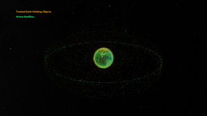
Space debris orbiting the Earth
Legenda: This animation shows objects orbiting the Earth. The data date from February 2024 and are taken from space-track.org which maintains a public catalogue of objects tracked by the United States Space Command (USSPACECOM).
At first in this video we see green dots, each representing one of the 31,000 human-made objects orbiting Earth. These include both operational and decommissioned satellites, used rocket stages from space launches, and fragments larger than 10cm created by collisions or explosions. Later in the video, some of the green dots are replace by orange dots, each of these representing one of the 9,300 operational satellites orbiting the Earth. Note that since February 2024 more satellites and rockets have been launched in to space and some objects will have fallen back to Earth, so these numbers will have changed.
We see two main groups of objects. The first are those objects orbiting close to the Earth, objects in low Earth orbit. These include communication satellites (many from the satellite constellations used to provide satellite internet services), Earth observation satellites, military satellites, two operational space stations and other objects such as rocket stages and other debris.
More distant from Earth we see a thin ring of satellites. These are in geostationary orbit. This is a special orbit where the orbital period matches the rotation period of the Earth. This means that a satellite in geostationary orbit stays above the same point on the equator and, when observed from the side of the Earth facing the satellite, will appear to stay at a position on the sky that does not change over time. Because of this, geostationary orbit is used by many communications satellites as a satellite dish on Earth used to receive or transmit a signal to that satellite can point in a fixed direction and does not need to dynamically track the satellite. Geostationary orbit is also used by weather observation satellites.
Crédito: NASA's Scientific Visualization Studio
link do crédito
License: PD Domínio Público ícones
Atividades relacionadas
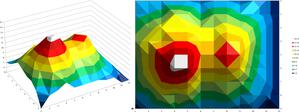
Valleys Deep and Mountains High
astroEDU educational activity (links to astroEDU website) Description: Learn how radar altimetry from satellites works and how to put landscapes on paper.
License: CC-BY-4.0 Creative Commons Attribution 4.0 International (CC BY 4.0) ícones
Tags:
Maps
, Earth observation
, Sentinel
, Copernicus
, Remote sensing
, Altimetry
, Radar
Faixas etárias:
14-16
, 16-19
Nível de ensino:
Ensino fundamental
, Médio
Áreas de aprendizagem:
Grupos de discussão
, Modelagem
, Aprendizagem por investigação estruturada
Custos:
Custo médio
Duração:
2 hours
Tamanho do grupo:
Grupo
Habilidades:
Analisar e interpretar dados
, Fazer perguntas
, Comunicar informações
, Desenvolver e usar modelos
, Usar matemática e pensamento computacional
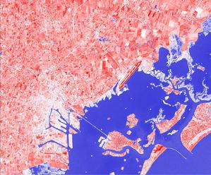
A View from Above
astroEDU educational activity (links to astroEDU website) Description: How do satellites take images of the Earth surface and how do we analyse and use them?
License: CC-BY-4.0 Creative Commons Attribution 4.0 International (CC BY 4.0) ícones
Tags:
Maps
, Climate
, Landsat
, Earth observation
, Sentinel
, Copernicus
, Remote sensing
, Vegetation
Faixas etárias:
14-16
, 16-19
Nível de ensino:
Ensino fundamental
, Médio
Áreas de aprendizagem:
Aprendizagem por investigação estruturada
Custos:
Baixo custo
Duração:
1 hour 30 mins
Tamanho do grupo:
Grupo
Habilidades:
Analisar e interpretar dados
, Fazer perguntas
, Comunicar informações
, Construir explicações
, Desenvolver e usar modelos
, Engajar-se em argumentação com base em evidências
, Usar matemática e pensamento computacional
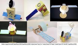
Build Your Own Artificial Satellite
astroEDU educational activity (links to astroEDU website) Description: Build a satellite to learn what they are made of and their uses.
License: CC-BY-4.0 Creative Commons Attribution 4.0 International (CC BY 4.0) ícones
Tags:
Art
, Creativity
, Hands-on
, Model
Faixas etárias:
8-10
Nível de ensino:
Básico
Áreas de aprendizagem:
Grupos de discussão
, Aula interativa
, Modelagem
Custos:
Baixo custo
Duração:
1 hour 30 mins
Tamanho do grupo:
Grupo
Habilidades:
Comunicar informações
, Desenvolver e usar modelos
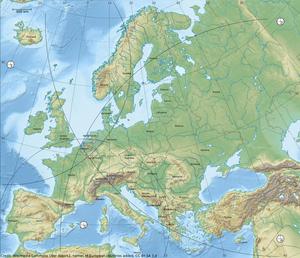
Where on Earth am I?
astroEDU educational activity (links to astroEDU website) Description: How do satellite-based positioning and GPS navigation work?
License: CC-BY-4.0 Creative Commons Attribution 4.0 International (CC BY 4.0) ícones
Tags:
Clocks
, Geography
, Maps
, GPS
, Countries
, Speed of light
, Galileo
Faixas etárias:
14-16
Nível de ensino:
Ensino fundamental
Áreas de aprendizagem:
Aprendizagem por descoberta guiada
, Resolução de problemas
Custos:
Baixo custo
Duração:
1 hour 30 mins
Tamanho do grupo:
Grupo
Habilidades:
Analisar e interpretar dados
, Fazer perguntas
, Comunicar informações
, Construir explicações
, Desenvolver e usar modelos
, Usar matemática e pensamento computacional