Termo do glossário: Lua
Descrição: A Lua é um corpo celeste que não emite luz por si só, mas reflete a luz solar que incide sobre ela. Isso dá origem às fases características da Lua. A Lua é o único satélite natural principal da Terra e ocupa o quinto lugar entre os satélites naturais do Sistema Solar em termos de tamanho e massa. A palavra “Lua” é escrita com letra maiúscula para distingui-la de outros satélites naturais, ou luas, no Sistema Solar e além dele. Em comparação com outras luas do Sistema Solar, a Lua possui o maior tamanho em relação ao tamanho do planeta que orbita. A Lua segue uma órbita elíptica ao redor da Terra, a uma distância média de 384.000 quilômetros (km). Ela não possui atmosfera e é composta por materiais semelhantes aos da Terra, com um núcleo rico em ferro e camadas externas rochosas. Essa semelhança não é por acaso: Pelo que sabemos, a Lua se formou a partir dos detritos da colisão entre a Terra e um planeta do tamanho de Marte há cerca de 4,5 bilhões de anos; a maior parte de seu material provém do manto da Terra original. A superfície da Lua apresenta áreas escuras conhecidas como mares, planaltos mais claros e está repleta de crateras. A área da superfície da Lua é de 3,79 × 10⁷ quilômetros quadrados, seu volume é de 2,20 × 10¹⁰ quilômetros cúbicos e sua massa é de 7,35 × 10²² quilogramas (kg). O valor exato do período orbital da Lua em torno da Terra depende do sistema de referência: em relação às estrelas distantes, ela completa uma órbita a cada 27,3 dias (“período sideral”). Para um observador na Terra, o tempo entre duas luas novas é de 29,5 dias (“período sinódico”).
Termos relacionados:
Ver este termo em outros idiomas
Status do termo e da definição: A definição original deste termo em inglês foi aprovada por um astrônomo(a) pesquisador(a) e um(a) professor(a) A tradução deste termo e de sua definição ainda aguarda aprovação
O Glossário Multilíngue da OAE é um projeto do Escritório da IAU de Astronomia para a Educação (OAE) em colaboração com o Escritório da IAU para Divulgação da Astronomia (OAO). Os termos e definições foram selecionados, escritos e revisados por meio de um esforço coletivo da OAE, dos Centros e Nós da OAE, dos Coordenadores Nacionais de Educação em Astronomia (NAECs) da OAE e de outros voluntários. Você pode encontrar uma lista completa dos créditos aqui. Todos os termos do glossário e suas definições são disponibilizados sob uma licença Creative Commons CC BY-4.0 e devem ser creditados à "IAU OAE".
Se você notar algum erro factual ou de tradução neste termo do glossário ou em sua definição, por favor entre em contato.
Mídia relacionada
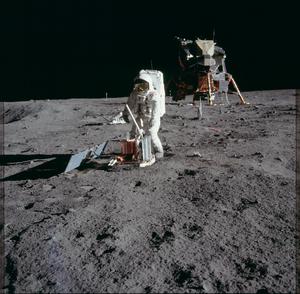
Atividade lunar da Apollo 11
Legenda: O astronauta da NASA Edwin 'Buzz' Aldrin instala um sismômetro em frente ao Eagle, módulo de pouso lunar da Apollo 11, durante uma atividade extraveicular (EVA) na Lua. Neil Armstrong tirou essa foto durante a primeira missão humana à superfície da Lua em 1969.
Crédito: Arquivo NASA/Projeto Apollo
link do crédito
License: PD Domínio Público ícones
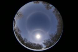
Selene meets the Moon, by Sheila Wiwchar, Canada
Legenda: First place in the 2021 IAU OAE Astrophotography Contest, category Sun/Moon haloes.
Photographed at Kaleida, Manitoba in Canada, this fisheye image beautifully captures the rare optical phenomena encircling the moon known as the “22° halo” and the horizontal white circle passing through the moon called the “paraselenic circle”. The white band circling the whole sky at the same altitude as the moon is named after Selene, the ancient Greek Titan, famously called the goddess of the moon. The more commonly observed counterpart produced by the sun is known as the parhelic circle, named after the Greek god of the sun, Helios. Both the 22° halo and the paraselenic circle are produced due to reflection of the moonlight from near vertical surfaces of ice crystals. Parts closer to the moon are caused due to external reflections, whereas those further away are created due to internal reflections. The constellation of the big dipper at the center makes this image even more spectacular. Can you spot it?
Crédito: Sheila Wiwchar/IAU OAE
License: CC-BY-4.0 Creative Commons Attribution 4.0 International (CC BY 4.0) ícones
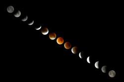
Red Moon, by Daniel Henrion, France
Legenda: Third place in the 2021 IAU OAE Astrophotography Contest, category Total lunar eclipse.
Time-lapse images of a total supermoon lunar eclipse that took place on 28 September 2015. The photos show the Moon during the time it moved through the Earth´s umbra: Earth´s umbra touched the Moon´s outer limb at 1.07 a.m. UTC (upper left corner) and left the Moon´s surface at 4.27 a.m. UTC (lower right corner).
Crédito: Daniel Henrion/IAU OAE
License: CC-BY-4.0 Creative Commons Attribution 4.0 International (CC BY 4.0) ícones
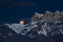
The eclipsed Moon sets near the Rochetta di Prendera, Dolomiti Unesco, by Alessandra Masi, Italy
Legenda: First place in the 2021 IAU OAE Astrophotography Contest, category Total lunar eclipse.
A lunar eclipse occurs when the full moon moves into the Earth`s shadow. This is the case when the Sun, Earth and Moon are exactly or very closely aligned. The reddish light reflected from the lunar surface is caused by sunlight that has been refracted on its way through Earth´s atmosphere in the direction of the Moon. It appears reddish because of the Rayleigh scattering of bluer light. The round shape of the Earth's shadow visible on the lunar surface was a proof for Aristotle that the Earth must be a sphere. This photo shows the eclipsed Moon that sets near the Rochetta di Prendera, Dolomiti Unesco, Italy, on 21 January 2019.
Crédito: Alessandra Masi/IAU OAE
License: CC-BY-4.0 Creative Commons Attribution 4.0 International (CC BY 4.0) ícones
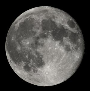
Lua cheia
Legenda: A imagem mostra a Lua quase cheia observada com um pequeno telescópio e uma câmera DSLR.
Crédito: Luc Viatour
link do crédito
License: CC-BY-SA-3.0 Creative Commons Attribution-ShareAlike 3.0 Unported ícones
Diagramas relacionados
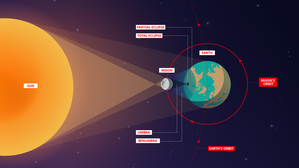
Total Solar Eclipse
Legenda: This not to scale diagram shows what happens during a total solar eclipse. The Moon orbits the Earth, but its orbit is slightly tilted with respect to the Earth’s orbit around the Sun. During the new moon lunar phase, the Moon lies between the Earth and the Sun, but due to the Moon’s tilted orbit around the Earth, the Moon normally lies above or below the Sun at this point. However twice a year the Moon’s orbit lines up in such a way that the Moon can lie in a direct line between the Earth and Sun. During each of these periods (each of which last roughly a month) solar (and lunar) eclipses can occur. The Moon is about 400 times smaller than the Sun, but is 400 times closer to the Earth than the Sun. Hence the Sun and Moon have approximately the same angular size when viewed from the Earth. This means that it is possible for the Moon to completely cover the Sun when viewed from Earth. This is known as a total solar eclipse.
Here we see a schematic of such and eclipse. The Moon casts a shadow on the Earth known as the umbra. This is a roughly circular shadow a few hundred kilometres across although its shape can be severely distorted when the eclipse is at the edge of the illuminated part of the Earth. Any region within the umbra will see the Moon completely cover the Sun and thus will experience a total solar eclipse. Outside of the umbra there are regions where the Moon will cover part of the Sun. This partial shadow is known as the penumbra. Regions in the penumbra will experience a partial solar eclipse.
An eclipse is a dynamic event with the Moon moving in its orbit and the Earth rotating. Hence the umbra and penumbra move across the Earth’s surface together. The path the umbra takes across the Earth is known as the path of totality. Let’s consider one particular region that lies in the path of totality: except in rare cases where an eclipse begins at sunrise, a region that experiences totality will first see the Moon cover part of the Sun and gradually move across Sun until it is totally covered. From outside the Earth this would appear as the penumbra moving over this particular region followed by the umbra moving over this region. Once the Moon moves so that it no longer completely covers the Sun, totality ends and the umbra moves away from this particular region. The Moon will continue to uncover the Sun until (unless the Sun sets before the end of the eclipse) the Sun is completely uncovered. From outside the Earth this would appear as the umbra moving away from our particular region and the edge of the penumbra approaching and eventually passing over the region.
Outside of the path or totality there is a much broader region that will lie in the penumbra but will be missed by the umbra. Such regions will not experience a total solar eclipse during this event, only a partial solar eclipse.
Crédito: Aneta Margraf/IAU OAE
License: CC-BY-4.0 Creative Commons Attribution 4.0 International (CC BY 4.0) ícones
Atividades relacionadas
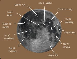
Lunar Landscape
astroEDU educational activity (links to astroEDU website) Description: Create craters and explore the lunar landscape with this hands-on activity.
License: CC-BY-4.0 Creative Commons Attribution 4.0 International (CC BY 4.0) ícones
Tags:
Hands-on
, Model
, Lunar landscape
, Craters
Faixas etárias:
4-6
, 6-8
, 8-10
Nível de ensino:
Básico
Áreas de aprendizagem:
Modelagem
Custos:
Custo médio
Tamanho do grupo:
Grupo
Habilidades:
Fazer perguntas
, Comunicar informações
, Desenvolver e usar modelos
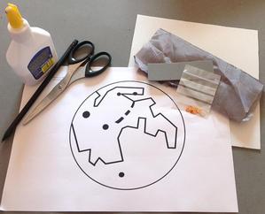
Meet Our Neighbours: Moon
astroEDU educational activity (links to astroEDU website) Description: Explore the tactile version of our moon with household materials.
License: CC-BY-4.0 Creative Commons Attribution 4.0 International (CC BY 4.0) ícones
Tags:
Hands-on
, Model
, Visually Impaired
, Tactile
Faixas etárias:
6-8
, 8-10
, 10-12
Nível de ensino:
Ensino fundamental
, Básico
, Médio
Áreas de aprendizagem:
Aula interativa
, Modelagem
Custos:
Baixo custo
Tamanho do grupo:
Grupo
Habilidades:
Analisar e interpretar dados
, Fazer perguntas
, Comunicar informações
, Desenvolver e usar modelos
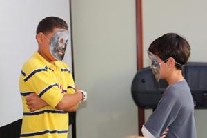
Lunar Day
astroEDU educational activity (links to astroEDU website) Description: Through a fun-learning activity, understand why moon always keeps the same face towards Earth.
License: CC-BY-4.0 Creative Commons Attribution 4.0 International (CC BY 4.0) ícones
Tags:
Lunar day
Faixas etárias:
4-6
, 6-8
Nível de ensino:
Básico
, Médio
Áreas de aprendizagem:
Modelagem
, Com foco em simulação
Custos:
Gratuito
Duração:
30 mins
Tamanho do grupo:
Grupo
Habilidades:
Analisar e interpretar dados
, Fazer perguntas
, Comunicar informações
, Construir explicações
, Desenvolver e usar modelos
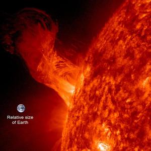
Sun, Earth and Moon Model
astroEDU educational activity (links to astroEDU website) Description: Build an Earth-Moon-Sun mobile to learn about how they orbit.
License: CC-BY-4.0 Creative Commons Attribution 4.0 International (CC BY 4.0) ícones
Tags:
Hands-on
, Model
Faixas etárias:
8-10
Nível de ensino:
Básico
Áreas de aprendizagem:
Aprendizagem mediada por jogos
, Modelagem
, Aprendizagem por investigação estruturada
Custos:
Custo médio
Duração:
1 hour 30 mins
Tamanho do grupo:
Grupo
Habilidades:
Fazer perguntas
, Comunicar informações
, Desenvolver e usar modelos
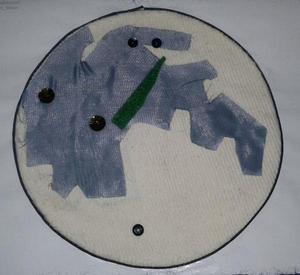
Children's Planetary Maps: The Moon
astroEDU educational activity (links to astroEDU website) Description: An up close look at our own satellite
License: CC-BY-4.0 Creative Commons Attribution 4.0 International (CC BY 4.0) ícones
Tags:
Maps
, Planetary cartography
, Spatial thinking
Faixas etárias:
6-8
, 8-10
, 10-12
, 12-14
Nível de ensino:
Ensino fundamental
, Básico
, Médio
Áreas de aprendizagem:
Aprendizagem por investigação estruturada
Custos:
Baixo custo
Duração:
2 hours
Tamanho do grupo:
Grupo
Habilidades:
Analisar e interpretar dados
, Fazer perguntas
, Comunicar informações
, Construir explicações
, Desenvolver e usar modelos
, Engajar-se em argumentação com base em evidências
, Planejar e realizar pesquisas